Environmental regeneration of the urban fringes in Massafra
At the gates of the invisible city
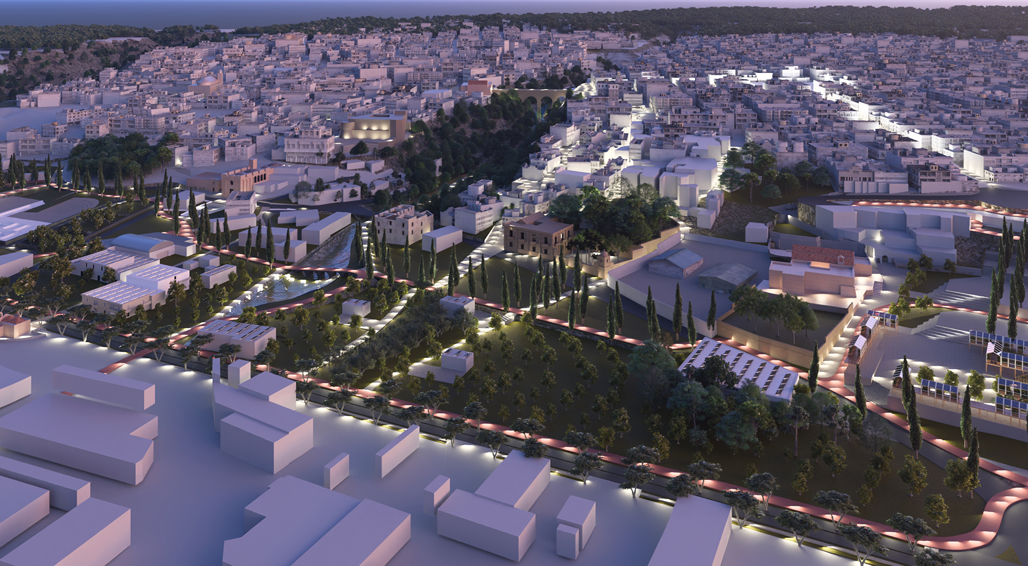
An international ideas competition—promoted by the Union of Municipalities of Crispiano, Massafra, and Statte—was held for the regeneration of the urban fringes in Massafra. NET submitted an entry “outside the competition” that envisioned reconstructing the site’s intangible value by stitching together green and blue infrastructure—linking the ravines to the plain—and supporting the creation of a large park featuring operators capable of attracting various uses and activities.
NET’s proposal received an Honorable Mention.
The project originates more from a narrative than from a drawing. Massafra is interpreted as a “dual” city, defined by the relationship between what is visible and what remains hidden: the plateau and the ravines, the surface and underground water, the built city and the natural landscape. This narrative approach is not simply a communication tool but becomes a genuine method for understanding the territory and guiding the design process. The result is a vision in which landscape, memory, and transformation overlap and mutually influence one another.
Urban Concept and Design Vision
The project is founded on the idea that the city is not a finished object but an evolving organism capable of developing through phases and adaptations. In this sense, the proposal is conceived as an open strategy that intervenes selectively and progressively within the existing urban fabric, adopting an infill approach that acts upon voids and discontinuities without imposing a predetermined form.
The design approach is based on an analysis of the territory’s morphogenesis, with particular attention given to the role of water and the structure of the ravines, elements that have historically shaped the identity of the city. The project therefore considers the natural ecosystem and the anthropogenic system as inseparable components, establishing a network of relationships between the historic city, the contemporary city, and linear infrastructures.
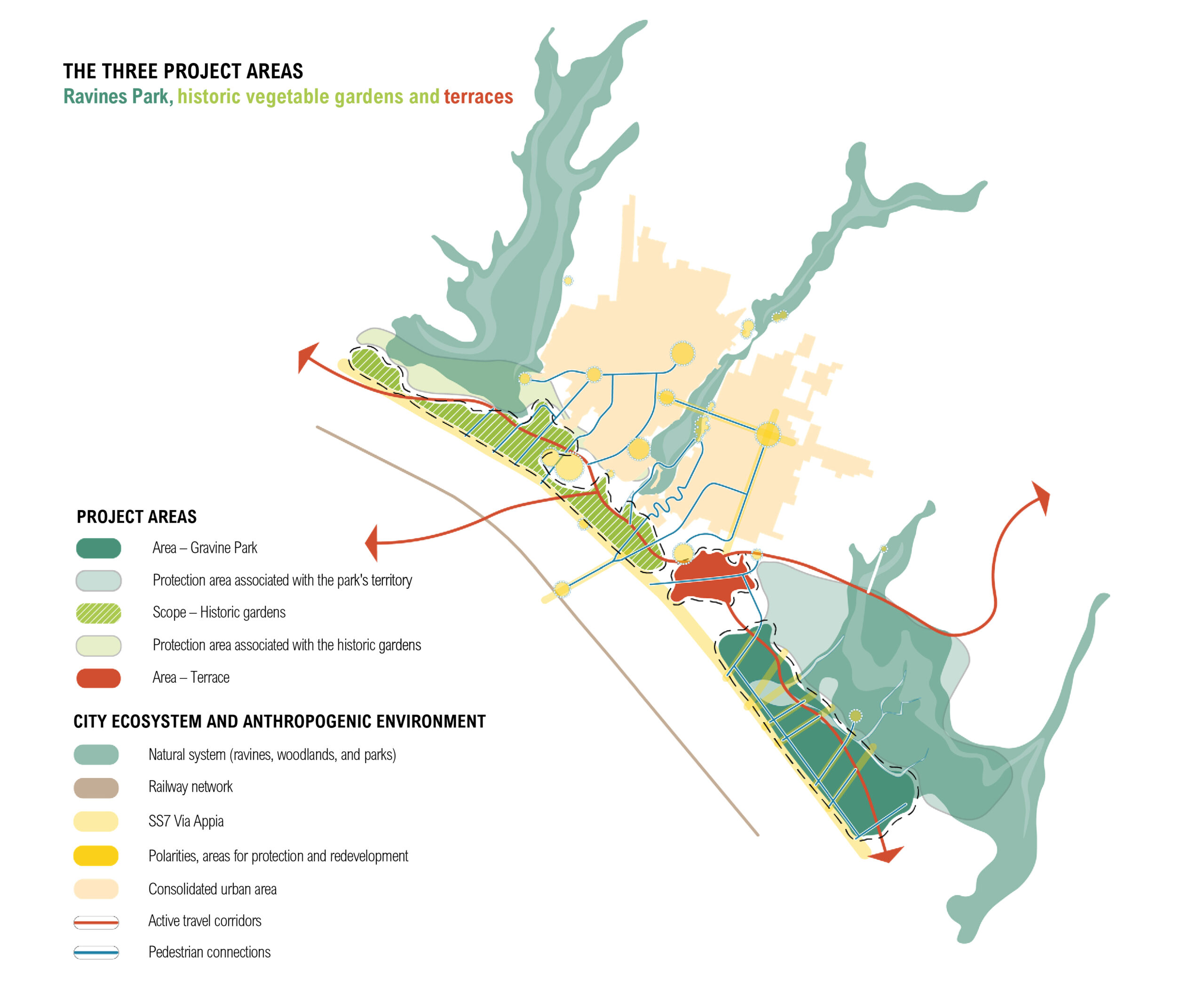
The masterplan is organized around three main areas, representing different interpretations of the relationship between nature and the city.
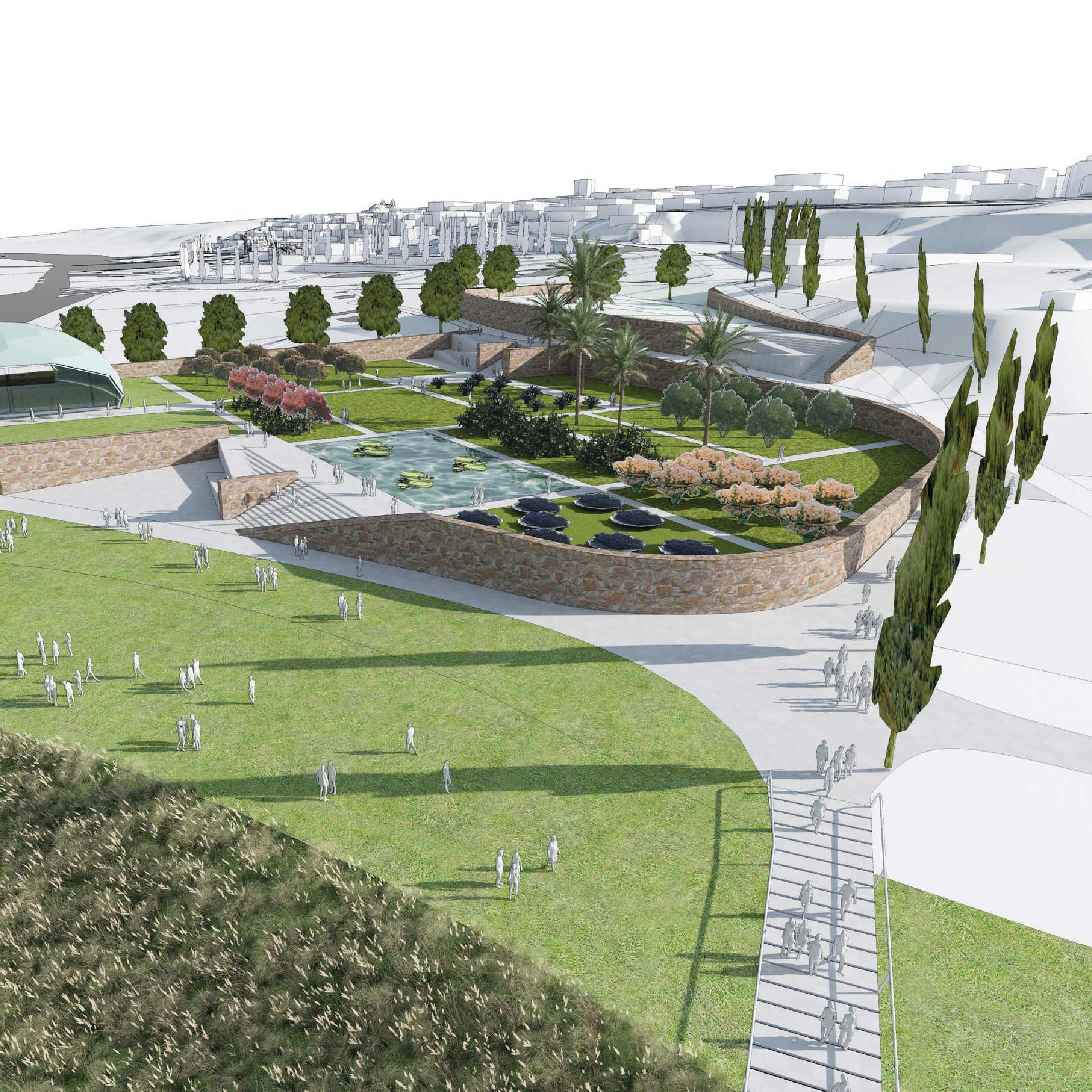
The Ravine Park is conceived as a large ecological and landscape system focused on naturalization, mitigation of hydrogeological risk, and the creation of accessible and connected public spaces.
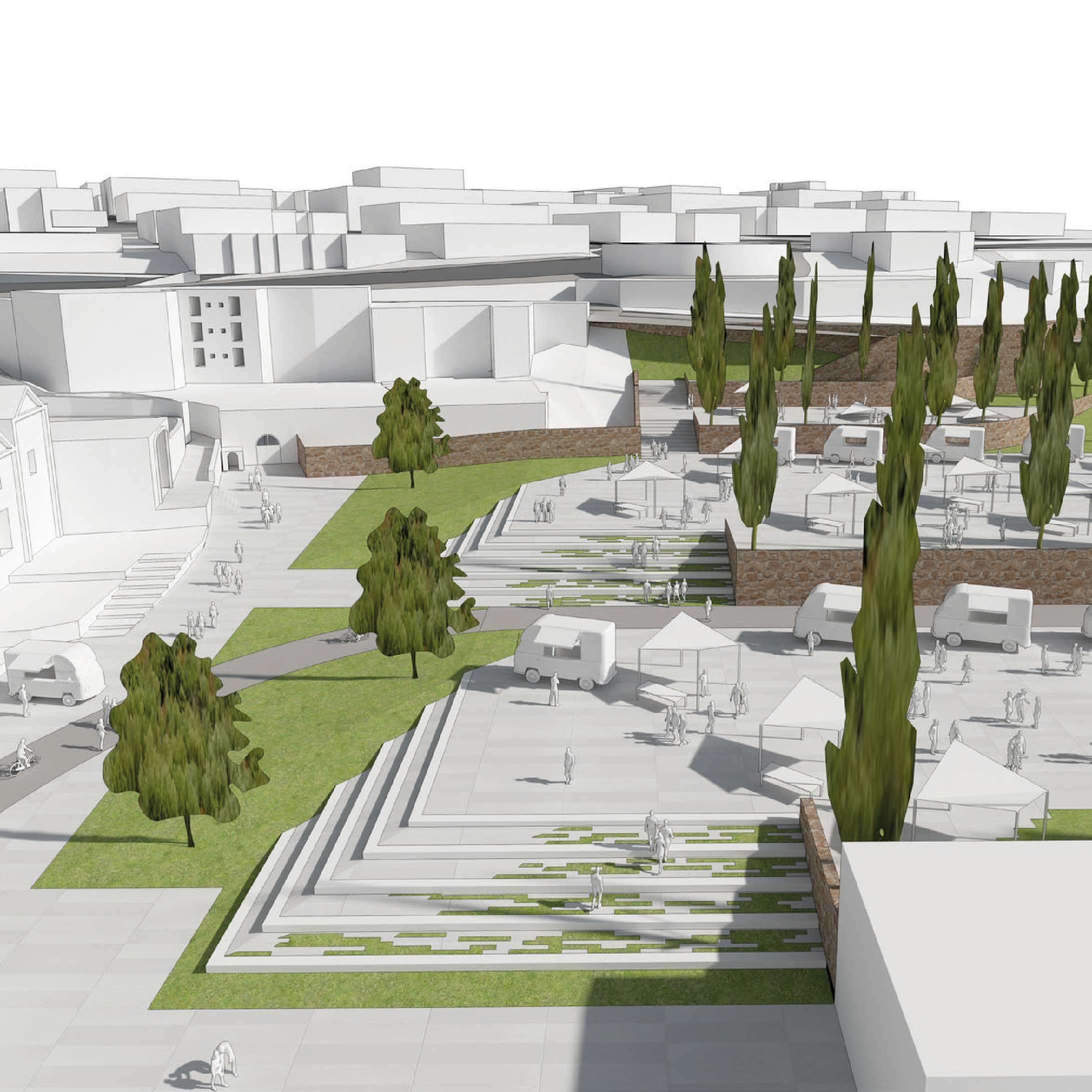
The historic gardens reintroduce an agricultural dimension within the urban environment, promoting processes of social and economic regeneration based on traditional cultivation practices, educational activities, and local supply chains.
The terraces act as a connecting device between different urban levels, conceived not as a single architectural element but as a “distributed gateway” capable of articulating and making access to the city more permeable.
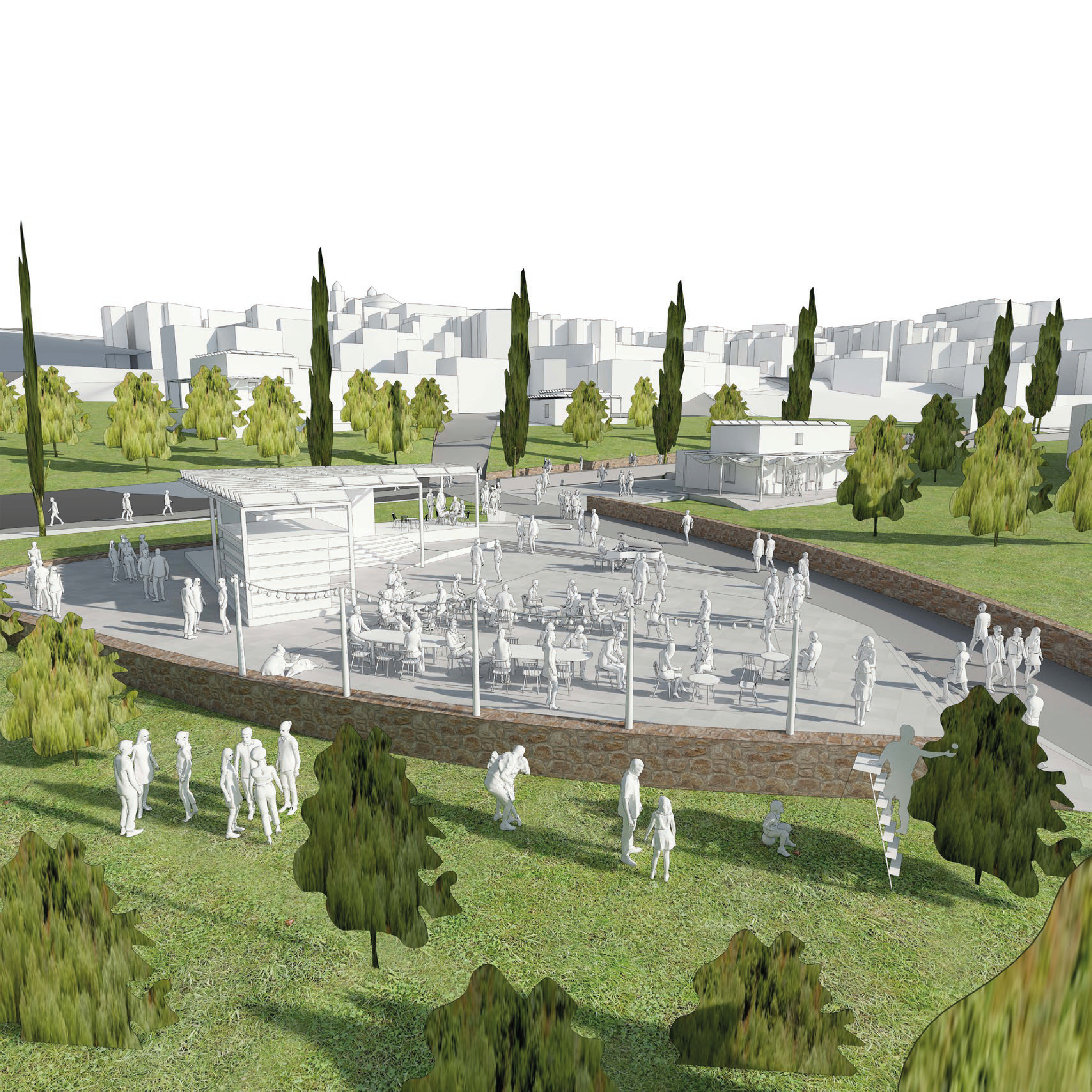
Masterplan, Mobility, and Public Space
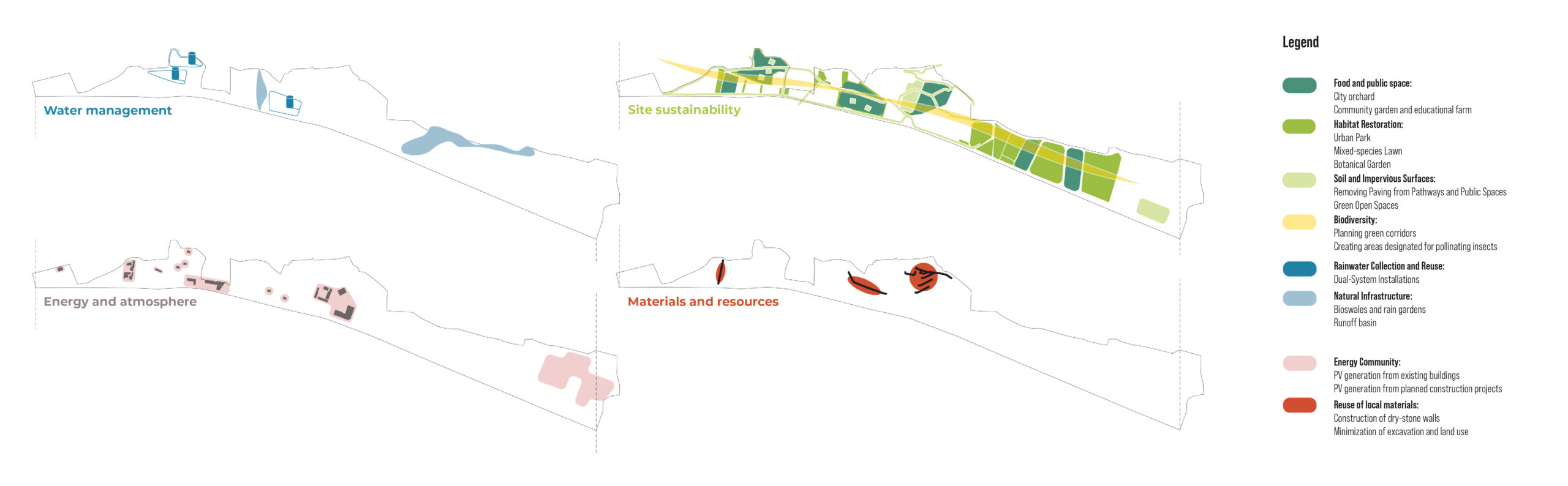
A central role is assigned to environmental sustainability, addressed through integrated strategies for water management, mitigation of the urban heat island effect, and biodiversity enhancement. The project includes the implementation of nature-based solutions such as rain gardens, bioswales, and permeable drainage systems, contributing both to climate resilience and to the landscape quality of public spaces. At the same time, the proposal promotes the development of an energy community and the use of local materials and sustainable construction techniques.
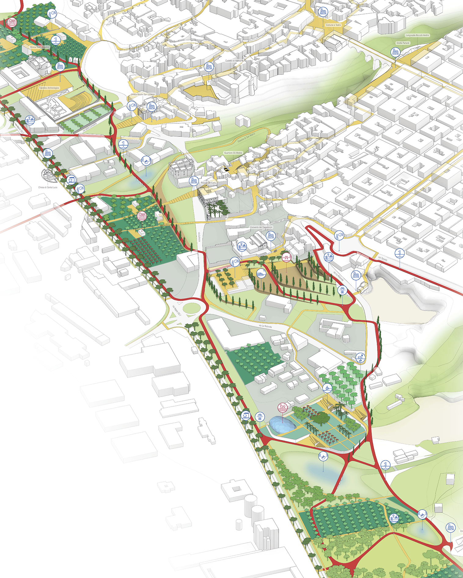
Mobility is redefined according to the principles of the “15-minute city,” prioritizing soft mobility and pedestrian-cycling connections between the different project areas and the surrounding territory.
The former Via Appia is transformed into an urban and landscape infrastructure capable of integrating local traffic, public transportation, and slow mobility routes into a coherent and hierarchical system.
The project introduces the concept of a “distributed museum,” enhancing the memory of the place and guiding the urban experience through wayfinding systems and narrative strategies.
The material components of the project—paths, public spaces, and materials—are closely linked to this dimension, contributing to the creation of a recognizable and identity-driven landscape.
Finally, the proposal is distinguished by its attention to feasibility and long-term management, organizing the intervention into independent phases and integrating partnership models between public and private stakeholders.
This flexibility allows the project to adapt to real implementation conditions while maintaining the continuity of the overall vision through progressive and modular interventions.
The project is conceived as a device capable of activating urban and territorial processes rather than defining a final form, positioning itself as a tool for revealing and enhancing the deeper identity of Massafra, between nature, memory, and contemporary transformation.