Using mobility to reshape the city

Roma Continua
NET Engineering, together with IT’S Vision, OMA, OKRA landscape architects and other collaborators, won the “A Vision for Rome” competition, organized by Fondazione Roma REgeneration to solicit ideas for a renewed vision of the Italian capital. The proposal, Roma Continua, shifts away from expansion and sprawl, prioritising green corridors, mobility hubs and adapative reuse.
With Roma Continua, NET Engineering has placed its expertise at the service of an integrated vision of the city, where mobility is a driver of urban transformation.
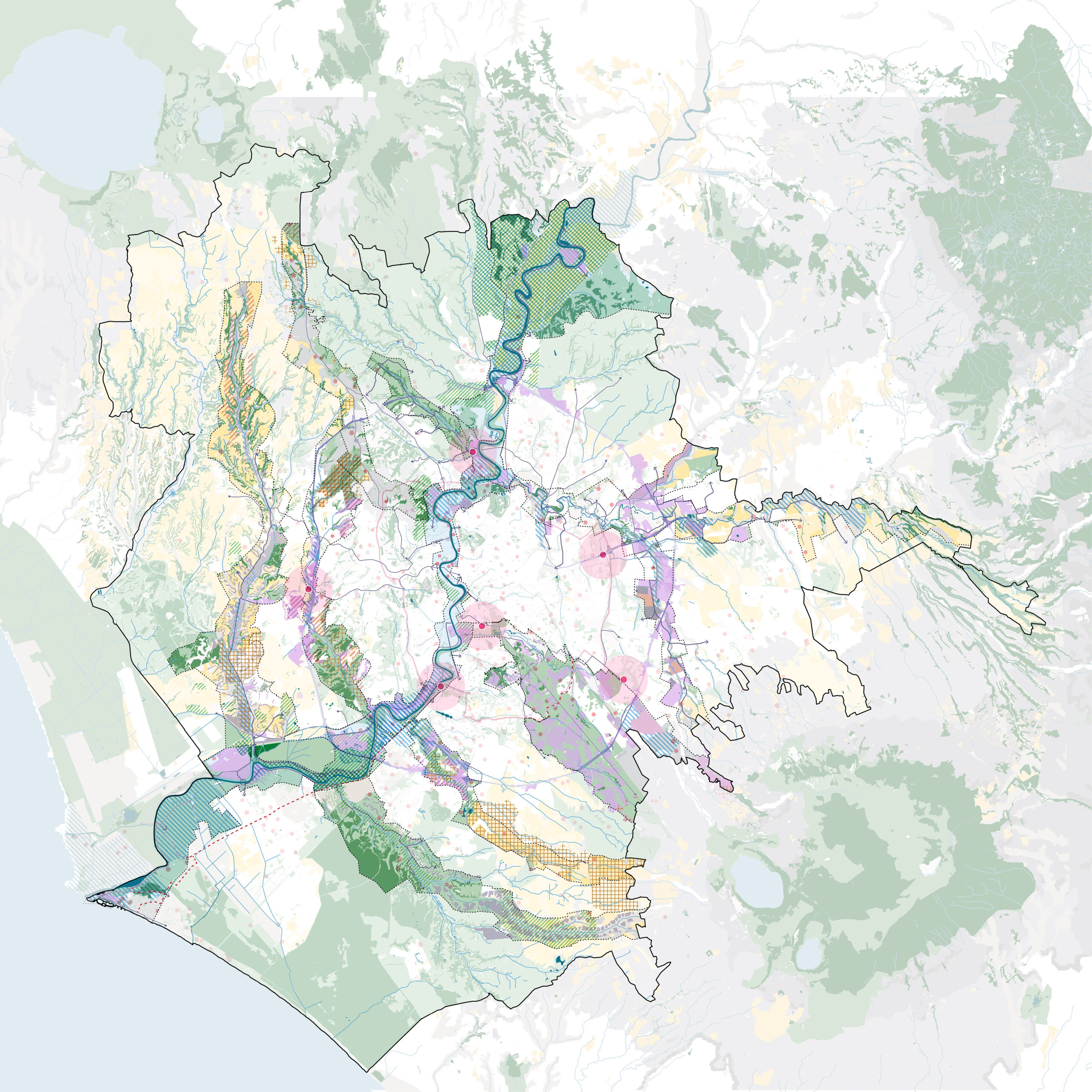
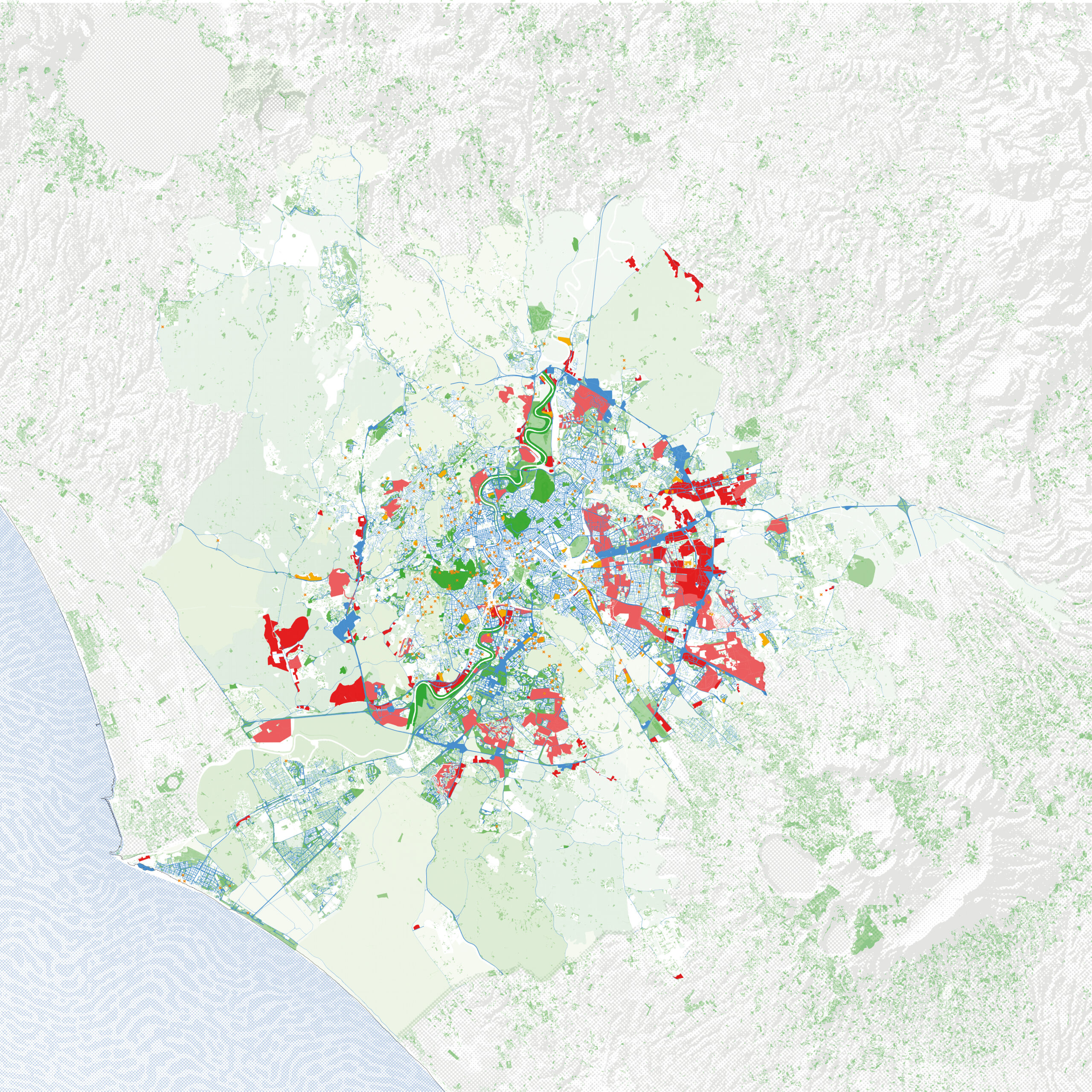
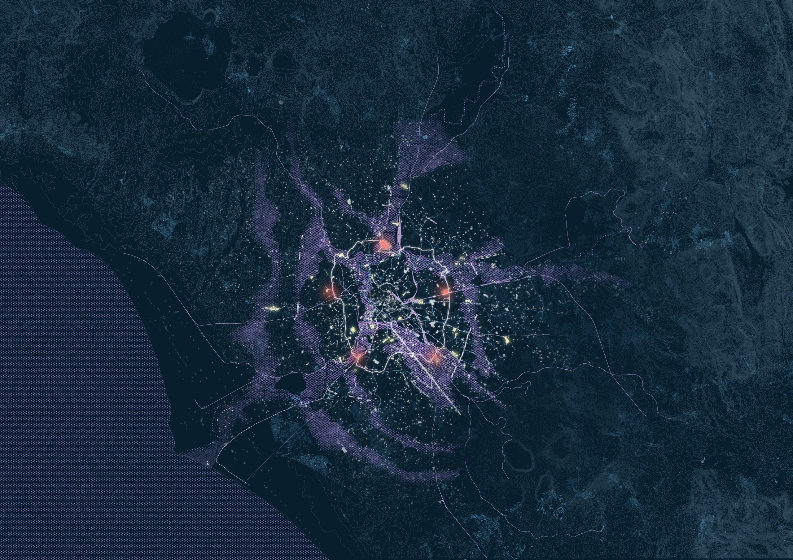
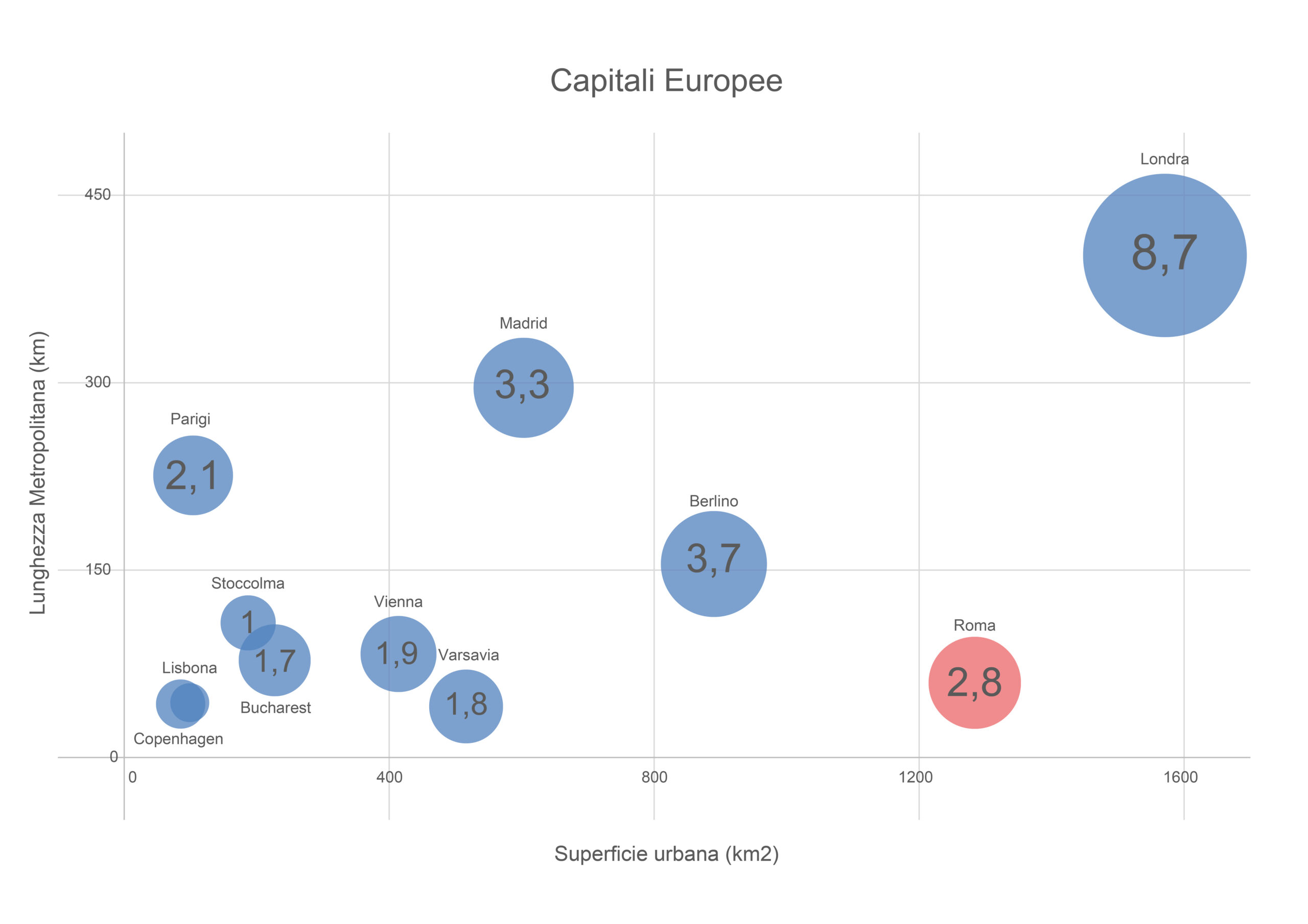
Rome escapes the conventional categories through which major European metropolises are usually interpreted. With more than 1,200 km² of surface area, the Italian capital is comparable in size to global cities such as London or le Grand Paris, yet without the same urban density. Its population is distributed unevenly and sparsely, with extensive low-density urbanised areas and large interstitial spaces between buildings, infrastructures and open land.
In this sense, Rome may be understood as an “empty London”: a city with an extensive metropolitan footprint, yet lacking the continuity of settlement and therefore the critical mass required to support efficient high-capacity mobility systems. This gives us a first structural inconsistency: a city as large as a global metropolis, but with densities and mobility demands more comparable to a collection of medium-sized cities placed side by side.
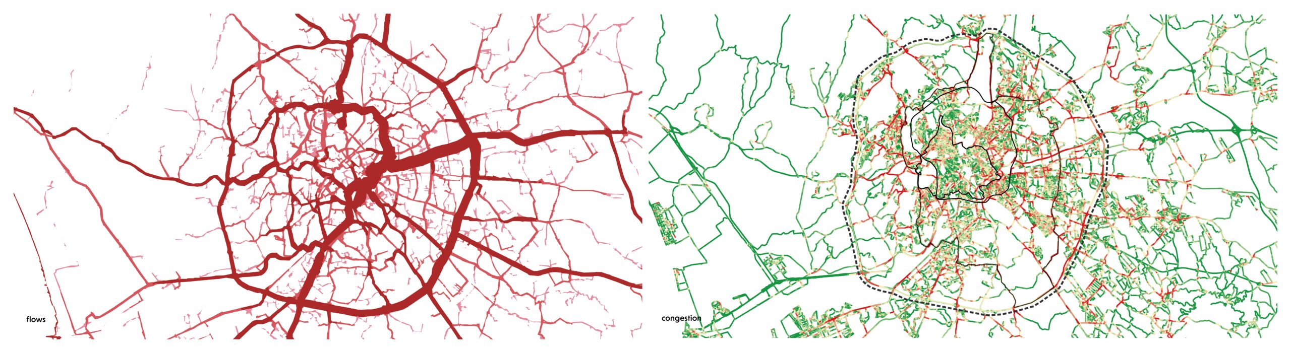
Overall, a low-density condition makes difficult to sustain an extensive and efficient public transport network, while the vast territorial extension naturally increases average travel distances. The result is a mobility system heavily dependent on private cars, not so much as an individual choice, but as the structural outcome of a dispersed urban model in which public transport struggles to compete in terms of travel time, frequency and accessibility.
A second major inconsistency follows the first: the overlap between a hyper-dense historic city and an overextended peripheral territory, connected mainly by radial infrastructures with weak transversal links.
In this context, access to services, workplaces and daily urban functions depends not simply on geographical distance, but on the actual possibility of moving efficiently between urban sectors, operating according to very different logics of densities and flows. The outcome is a highly unequal condition of accessibility for the overall urban environment. Rome is therefore not merely a city “with traffic problems”, but an urban organism in which mobility and accessibility reveal the intrinsic contradictions of its settlement model. The mismatch between territorial extension, residential density and infrastructural provision represents a structural constraint affecting every attempt to reorganise the transport system.
Within this framework, the Sustainable Urban Mobility Plan (PUMS), approved already in 2024, outlines a progressive implementation scenario, capable of significantly influencing accessibility and modal distribution across the city.
In particular:
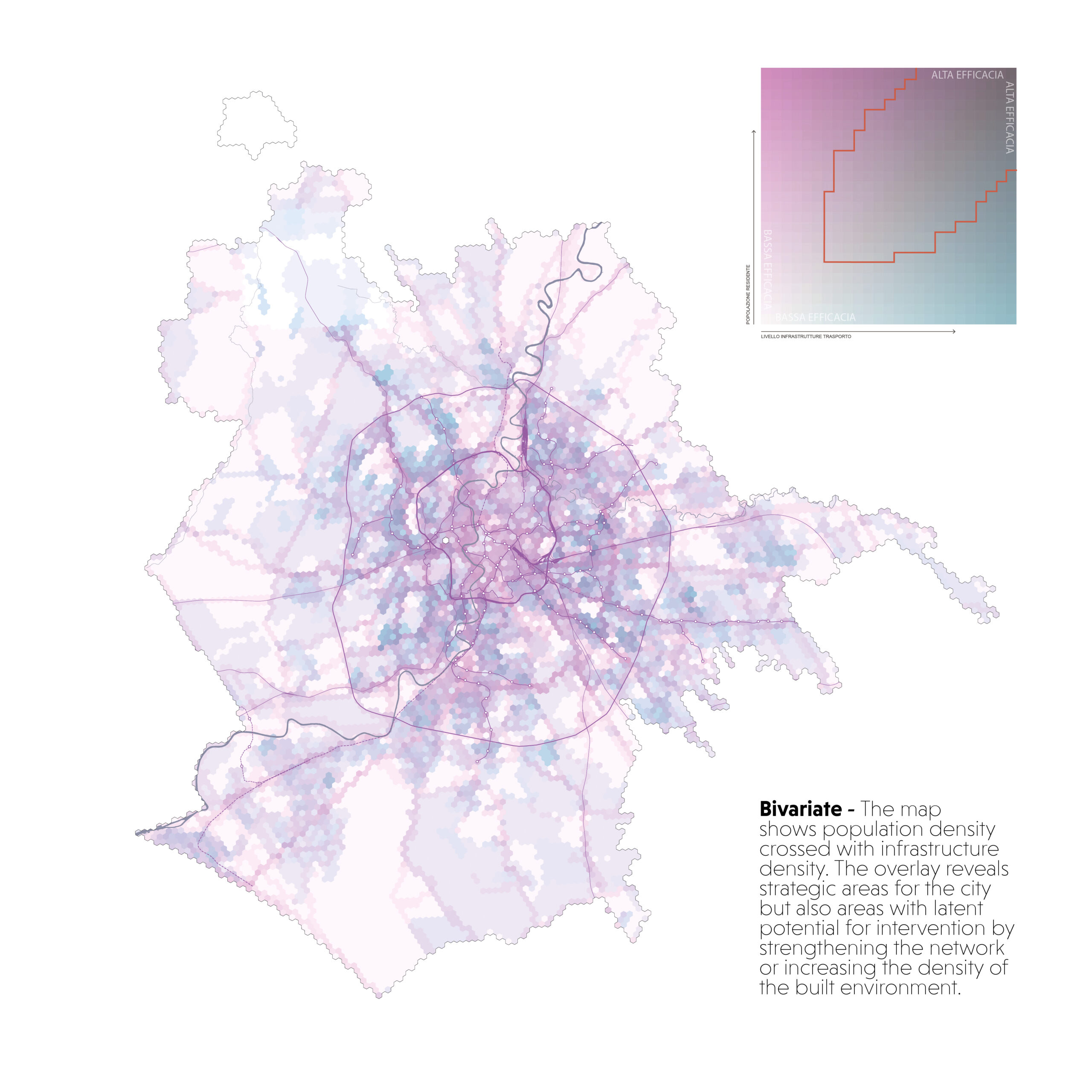
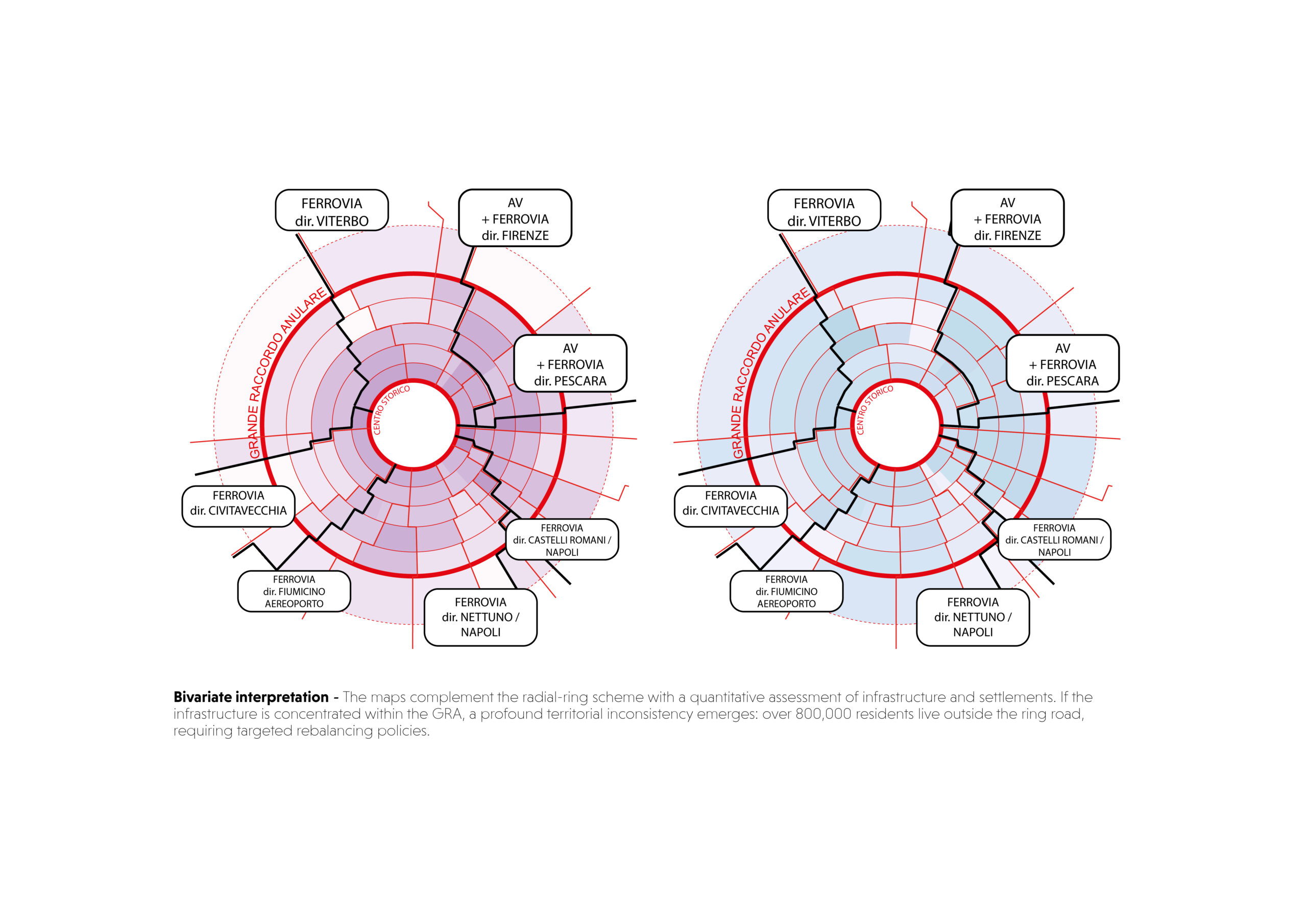
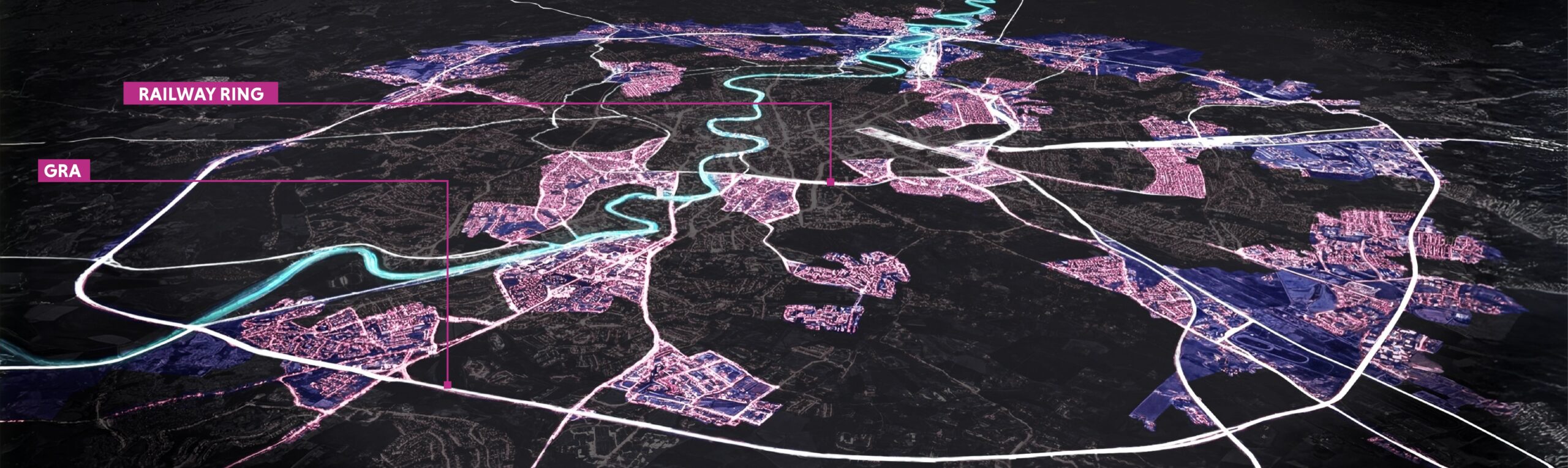
The scenario outlined by the PUMS forms the starting point of this research, which adopts the infrastructural framework as a consolidated condition to be evaluated in relation to its territorial impacts.
The attention therefore shifts from the representation of current mobility patterns towards the capacity of the new infrastructural framework to generate unexplored opportunities for mobility and urban development. The research does not question the infrastructural framework of the PUMS, but rather investigates how it may become a projective tool through which Rome
can be reimagined from the perspective of its network: not merely as a technical transport system, but as a spatial infrastructure capable of guiding urban, settlement and economic transformations.
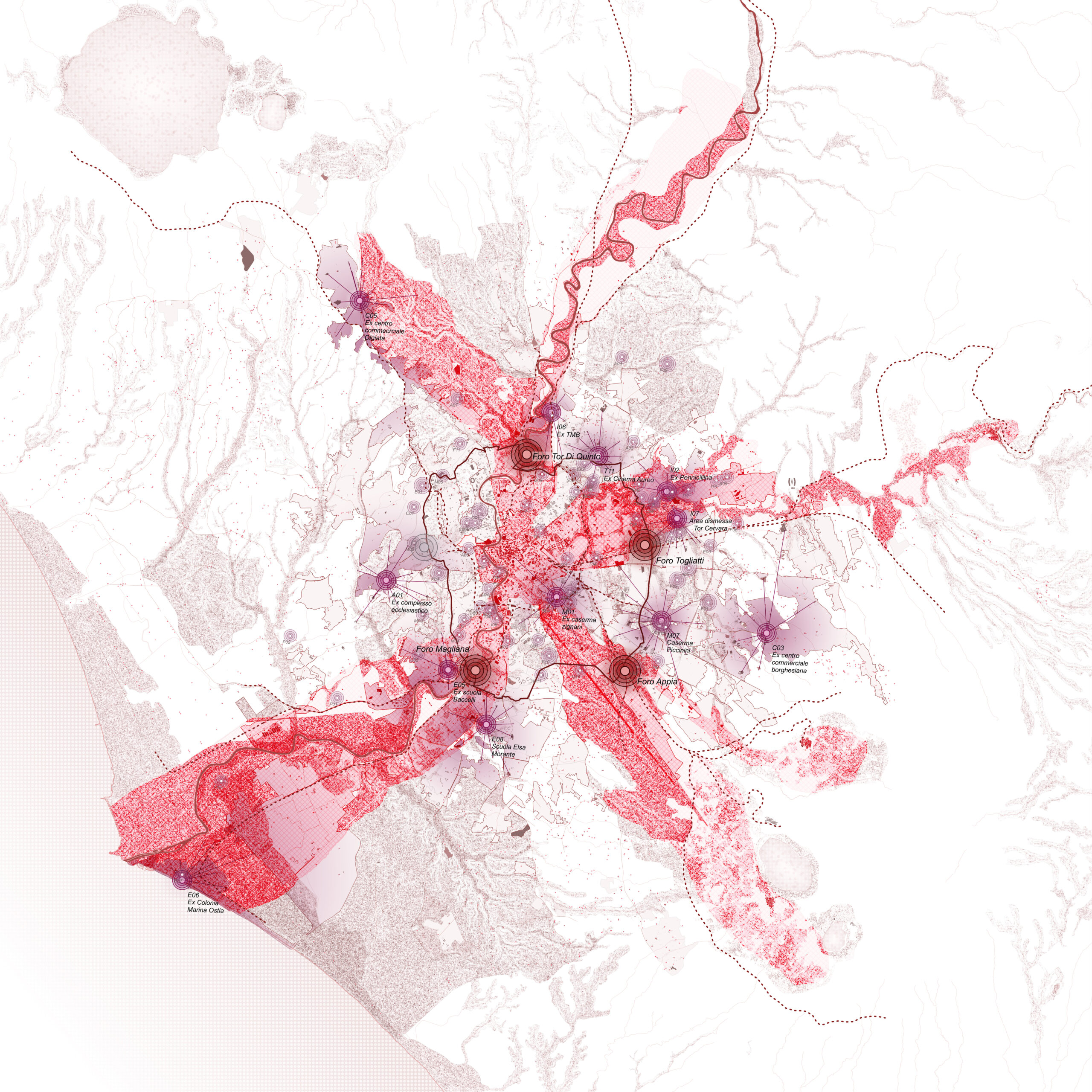
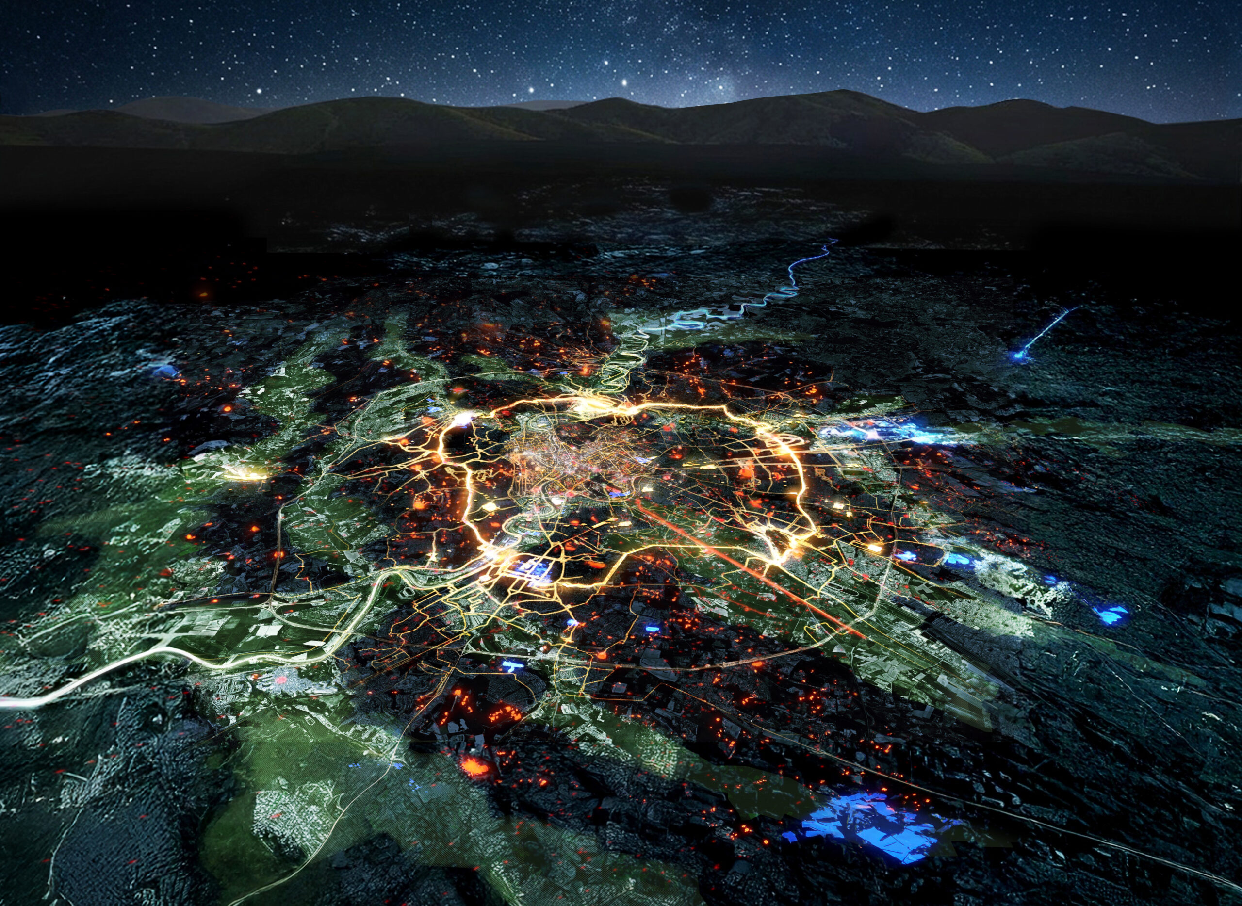
Rome confirms itself as a plural city: simultaneously distant and near, centripetal and polycentric, natural and constructed, historical and re-imagined. Existing infrastructures are already extensive and articulated throughout the city, while their interchange nodes potentially define an already continuous network.
Strategy
The vision of “Roma Continua” emerges from these considerations. Mobility infrastructures become both the starting point and the instrument for constructing a more accessible, equitable and legible city.
A city in which continuity is not determined by building density, but by the quality of connections, functional proximity and by the possibility of moving effectively inside neighbourhoods, between neighbourhoods and on the metropolitan scale.
Hence, the strategy is based on identifying different levels of living and therefore evaluating their accessibility.
Three main areas of intervention are identified:
- Metropolitan and urban scale, where mass rapid transit and the primary road network constitute the backbone of accessibility;
- Inter-neighbourhood scale, characterised by cycling infrastructure and low- to medium-capacity public transport;
- Neighbourhood scale, centred on walkability and local cycling mobility.
Metropolitan scale
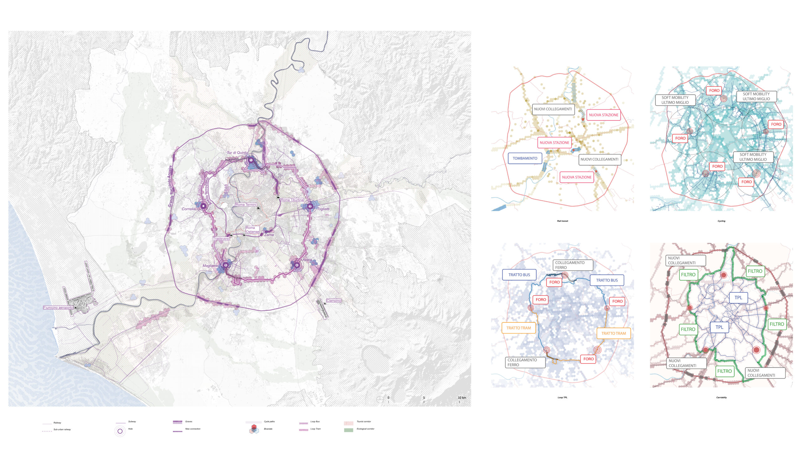
At the metropolitan scale, three strategic actions are identified:
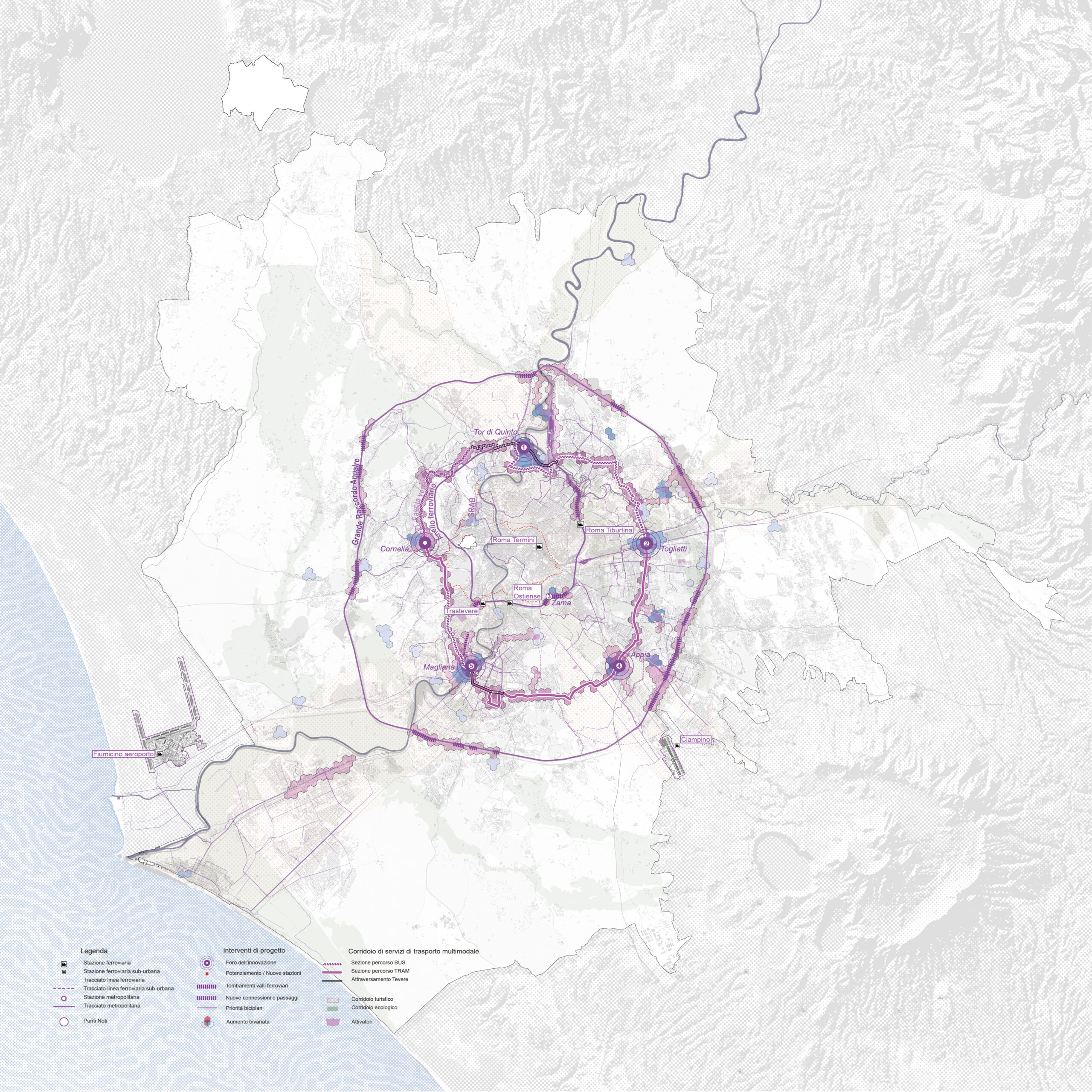
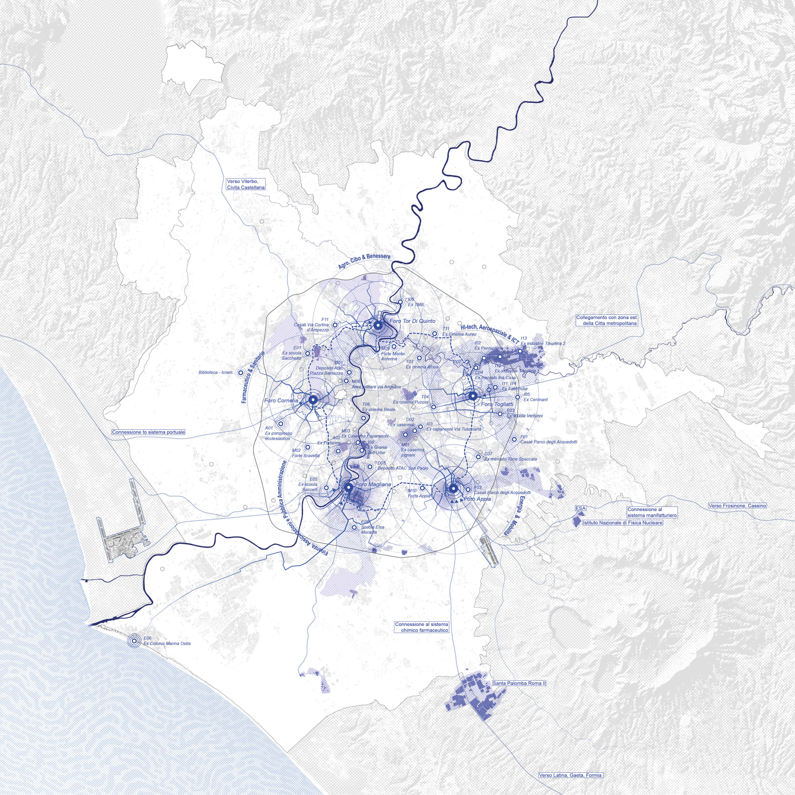
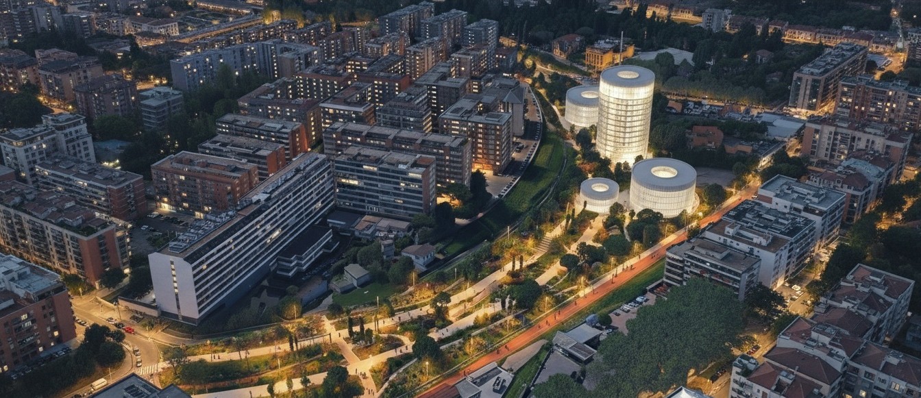
- the system of the five “Fori dell’Innovazione” – Togliatti, Appia, Magliana, Cornelia and Tor di Quinto – strengthens existing interchange nodes and introduces new ones, acting as drivers of urban transformation;
- the connection between the five Fori through a multimodal corridor creates an intermediate circular distribution system between the railway ring and the GRA orbital motorway;
- new railway stations – Statuario, Cornelia, Tor di Quinto and Zama – are reinterpreted according to Transit-Oriented Development principles as devices for urban transformation.
Local and inter-neighbourhood scale
At the local and inter-neighbourhood scale, the strategy includes:
- new development of areas located within urban interstices and void spaces;
- reconnection interventions addressing the “cuts” produced by major transport infrastructures and barriers;
- new accesses and soft-infrastructures serving regenerated and reused areas.
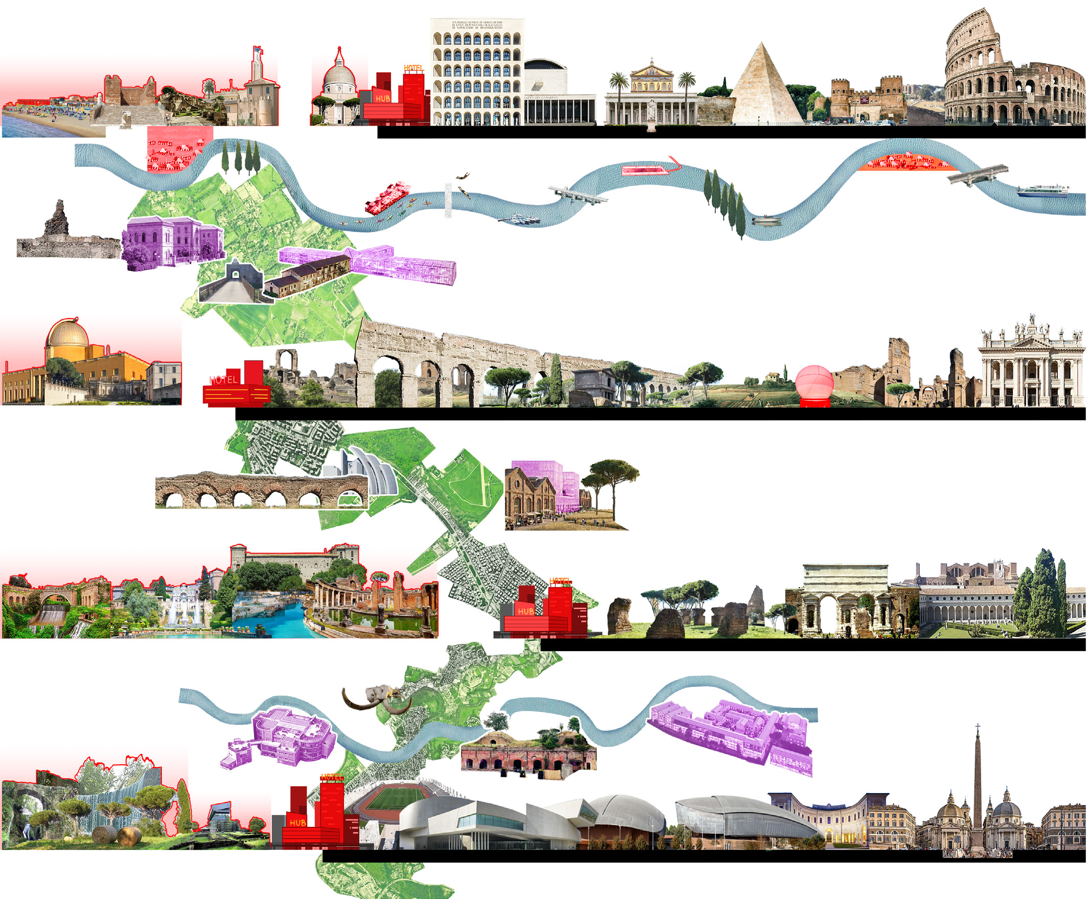
Taken together, these actions outline a different Rome from the one currently perceived: a continuous city in which ecological and tourist corridors become interpretative frameworks capable of guiding infrastructural and urban choices.
The reuse and regeneration of available spaces become opportunities for the creation of brand new local mobility infrastructures and services, while major TOD interventions along the rail network reinforce Rome’s role as a hinge between urban, metropolitan, regional and interregional scales.
The combined effect of these strategies allows Rome to achieve a qualitative leap in both internal and external connectivity, enhancing current and future infrastructural investments.
Rome thus becomes a more continuous city, one capable of bringing its neighbourhoods closer together and transforming mobility into a structuring instrument for a modern model of urban development.