Studying the Impacts of Urban Construction Sites: the Case of Bologna

The Transitional City
In recent years, Italian and European cities have been going through a phase of profound transformation in urban mobility, marked by unprecedented investment in mass public transport infrastructure. The relaunch and expansion of tram networks, the launch of new metro lines and the extension of existing lines are no longer future prospects but a concrete reality: construction sites spread across historic centres, residential neighbourhoods and outlying areas, with the aim of reducing dependence on private cars, improving accessibility and addressing the challenges of environmental and social sustainability.
In Italy, thanks in part to resources from the National Recovery and Resilience Plan (PNRR), which has recently come to an end, a genuine “tram spring” is underway: projects are in progress for over 250 km of new tram lines, with investments exceeding 5 billion euros, and works in numerous cities including Bologna, Padua, Florence, Palermo and Rome, aimed at strengthening or renewing existing tram infrastructure.
The construction of new public transport infrastructure entails high technical and organisational complexity, with short-term consequences that can prove critical for the quality of urban mobility.
The main problems caused by construction sites include:
- Increased travel times
- During the excavation and track-laying phases, many urban roads undergo lane restrictions, traffic diversions and temporary closures, generating more intense vehicle congestion and lengthening travel times. Bus route diversions to allow works to proceed can also lead to less direct connections and reduced frequencies
- Spatial segregation and fractures in the urban fabric
- Extensive construction sites can act as physical barriers within the urban fabric, separating neighbourhoods and reducing pedestrian and cycling accessibility. Areas that were previously well connected can become isolated for months or years, with significant social impacts, especially for the most vulnerable communities or for those who depend on walking or cycling routes
- Vulnerability of transport networks
- The vulnerability of mobility networks during the construction phase does not depend solely on the extent or duration of the works, but is strongly influenced by the morphological and topological structure of the urban network in which the construction site is located
rapid temporality and permanent transformation
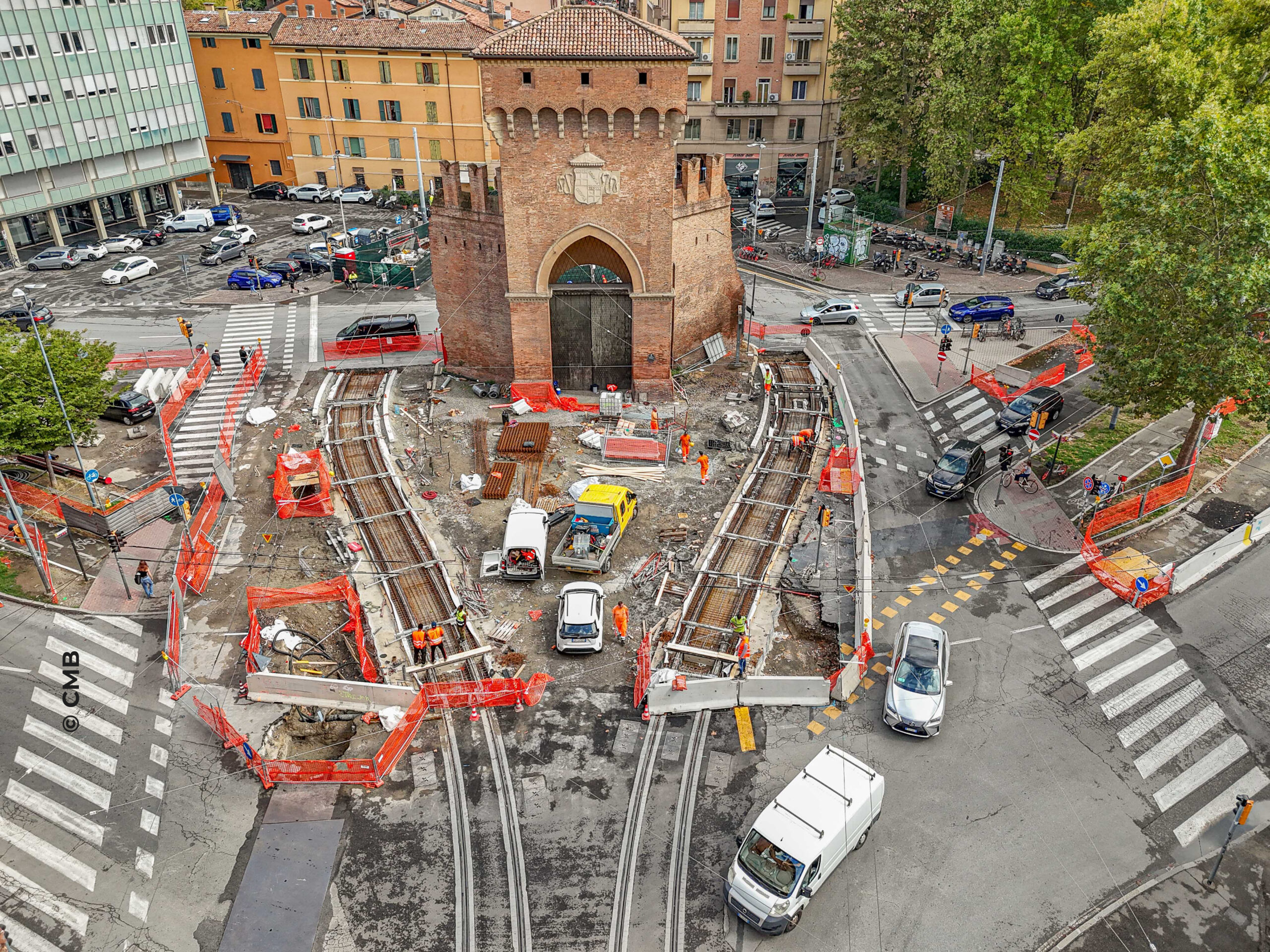
The construction site for building a tram line has peculiar characteristics that make it particularly complex to assess in terms of impacts on urban mobility.
Unlike other major infrastructure works, the tramway construction site is neither static nor confined to a single point in the territory, but takes on a linear and progressive nature, advancing along the road axis at a relatively high speed.
The works to lay the tram track bed typically develop in successive phases, affecting stretches of road a few hundred metres long and moving over time from one segment to another.
Over the course of weeks or a few months, the construction front advances, rapidly changing the mobility scenario: a road can go, in a very short time, from a fully functional axis to a heavily penalised or closed corridor, traffic and public transport diversions are updated frequently and user behaviour is forced to continuously readjust.
This high temporal variability makes it difficult to stabilise flows and amplifies the perception of disruption, especially in urban contexts where alternative routes are limited. The impact of the tramway construction site is therefore intense but relatively brief on each section, concentrating significant effects on travel times, accessibility and service regularity within a limited period.
Unlike localised, long-duration construction sites (such as those for metro stations), the tramway construction site does not accumulate impacts in the same place for years, but distributes them along the route. This produces a situation in which:
- the impact is locally very high;
- but tends to dissolve rapidly in space once the laying phase is completed.
However, this apparent “temporariness” should not be interpreted as reduced significance of the effects: the rapid succession of construction sites can in fact generate systemic instability of the network, with effects that also spread beyond the segment directly affected.
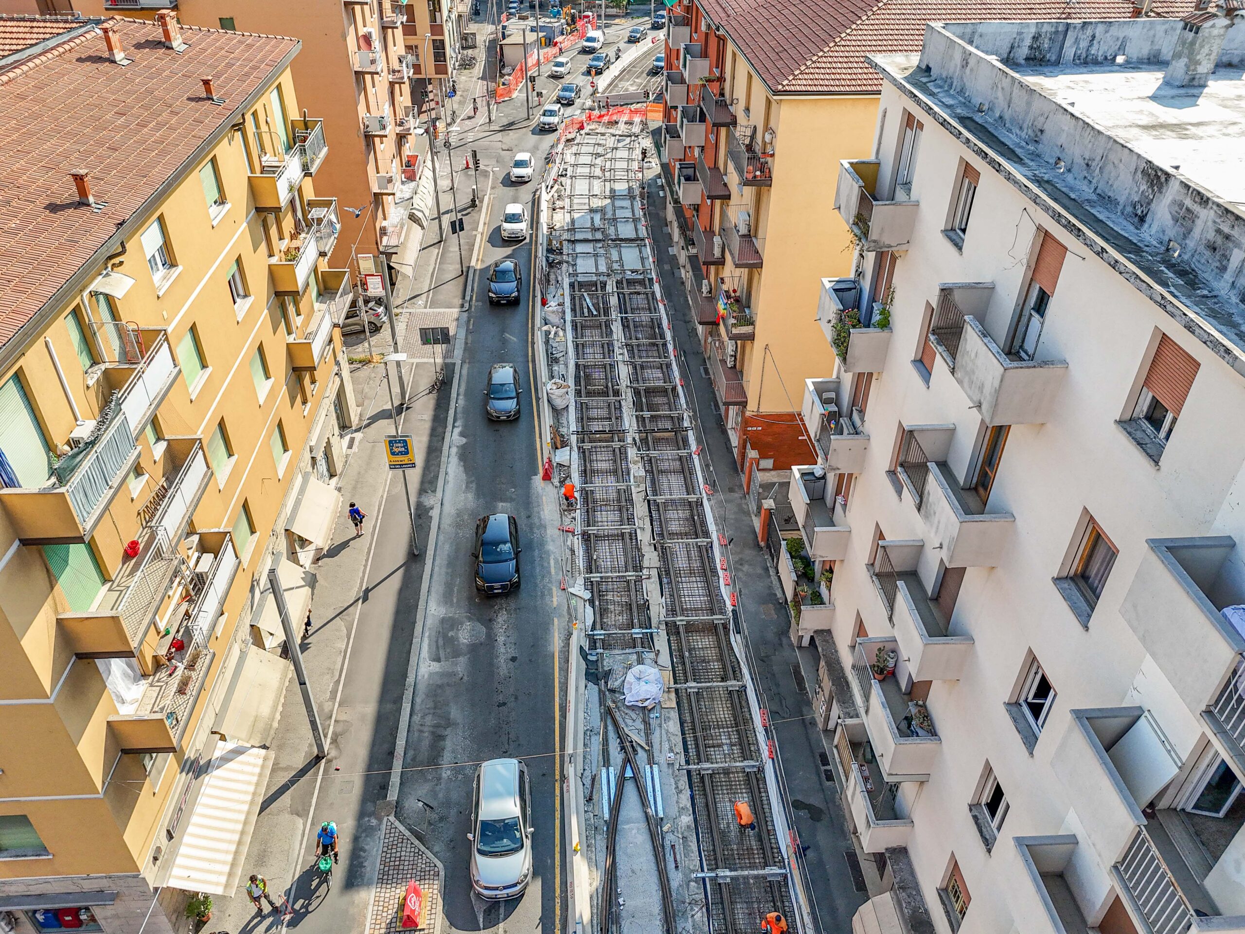
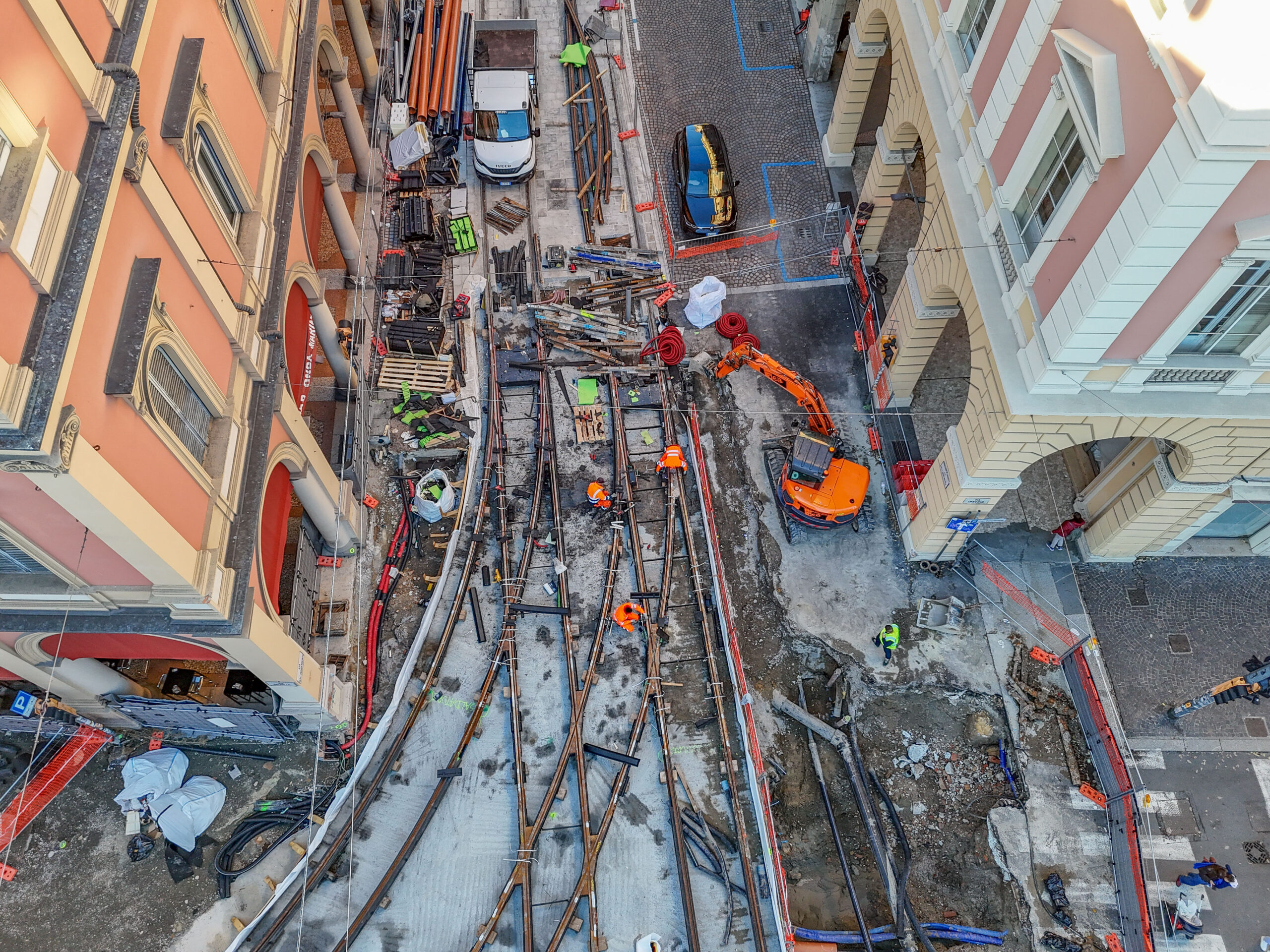
The distinctive feature of the tramway construction site lies in the fact that, once completed, it does not return the road space to its original configuration. The construction of the tram track bed involves a structural and permanent transformation of the road section, which has a lasting effect on the layout of urban mobility.
In many cases, the new configuration involves reducing the number of lanes for private traffic, physically separating carriageways, reorganising public transport stops, and introducing or enhancing pedestrian and cycling spaces.
As a result, the construction site does not represent merely a transitional phase of disruption, but the moment of transition towards a new functional balance, in which road hierarchies, traffic flow capacity and modal priorities change.
This dual nature – temporary in construction effects, permanent in spatial outcomes – makes the tramway construction site a phenomenon particularly relevant for the analysis of mobility impacts. During the construction phase, the system is subjected to high but short-lived stress; once the work is completed, the system must instead adapt to a new stable configuration, which may bring benefits in the medium-to-long term but requires a settling-in phase.
In this sense, the tramway construction site acts as a device for urban transition, capable of accelerating changes in mobility behaviour: a modal shift towards public transport, reduced use of private cars, and reorganisation of daily routes.
The assessment of impacts caused by tramway construction sites must therefore take into account two distinct time scales:
- a short-term scale, measuring the acute effects of the construction site as it progresses (congestion, vulnerability, temporary segregation);
- a medium-to-long-term scale, analysing the permanent transformation of the network and the road section.
Only by integrating these two dimensions is it possible to fully understand the specificity of the tramway construction site and support design and management decisions capable of mitigating temporary disruptions and maximising the structural benefits of the project.
In a context such as the one described, the use of a Decision Support Tool (DST) represents fundamental support for the preventive assessment of traffic scenarios associated with the different phases of construction.
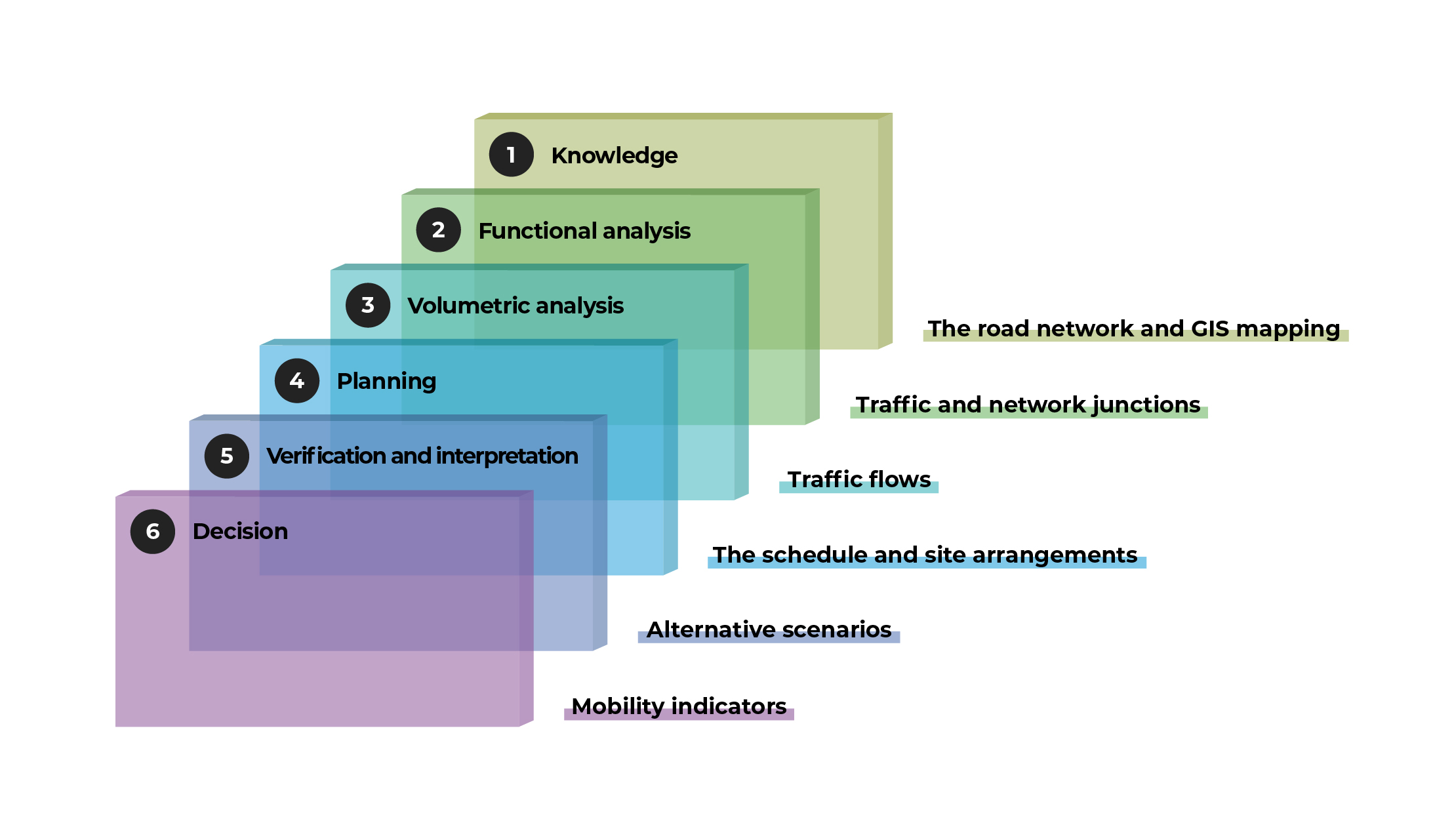
The tool is designed to analyse and compare different construction configurations, estimating their effects on road traffic, travel times, congestion levels and territorial accessibility, based on a structure of “knowledge layers” and “processing layers”.
Knowledge: this is the layer of the road network, in its functional and geometric characteristics: dimensions, geometric characteristics of areas outside the carriageway, etc.
Functional analysis: this is the layer of the road network in its regulatory characteristics: traffic and parking rules, management of junction regulation, etc. The two layers determine the capacity of each individual road link, defined as the number of vehicles that can pass through per unit of time.
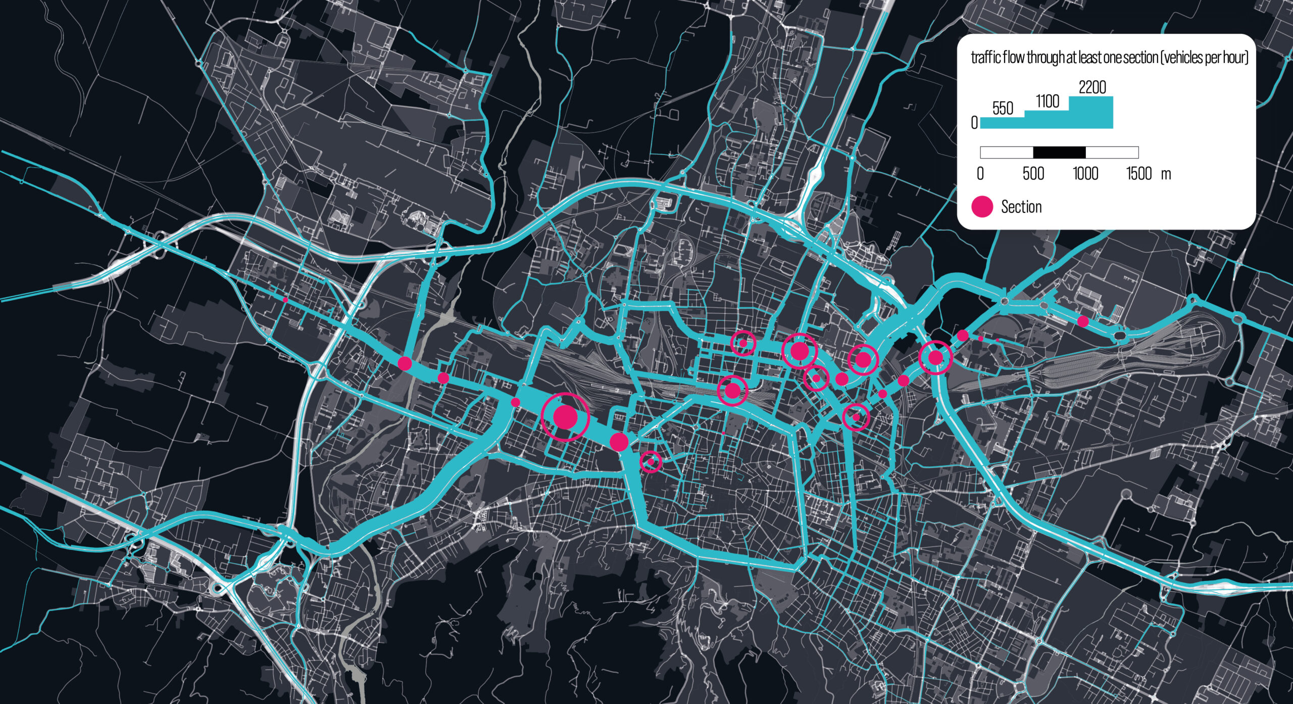
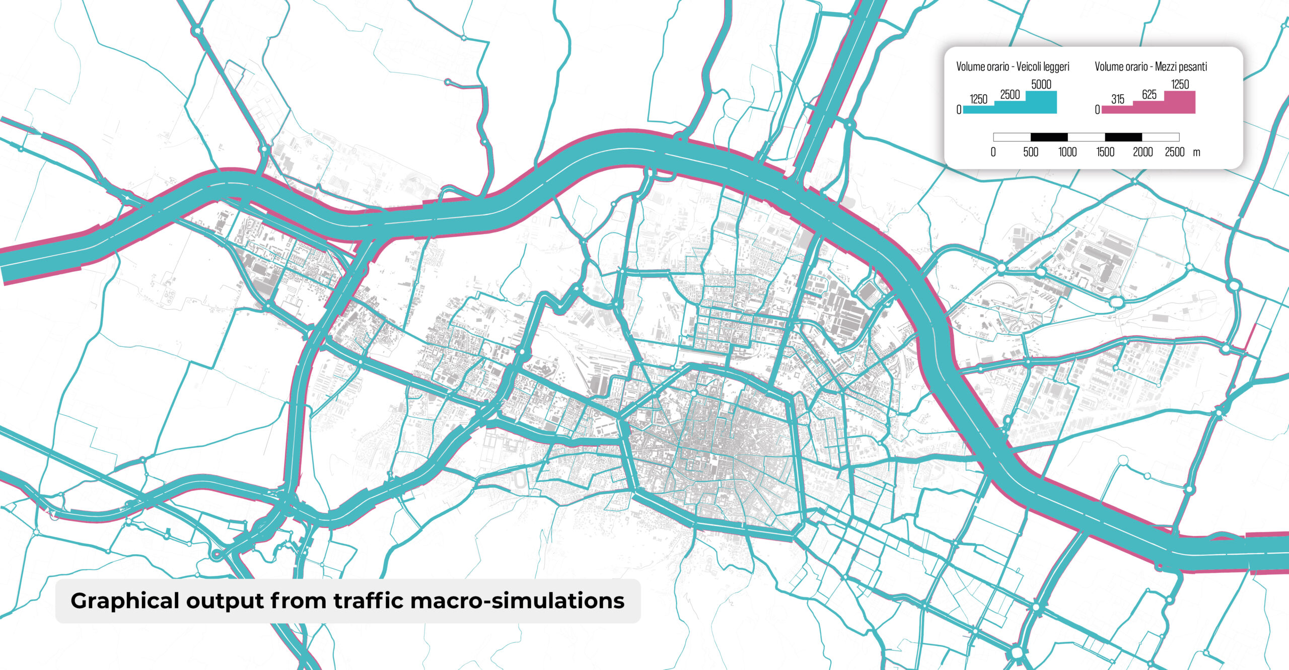
Volume analysis is the layer that represents the current use of the network, in terms of vehicles in transit. In particular, the analyses assess the traffic flows directly affected by the construction sections.
In the figure above illustrates the diagram of the flows in the city of Bologna passing through the sections shown in magenta, which correspond to specific construction sections.
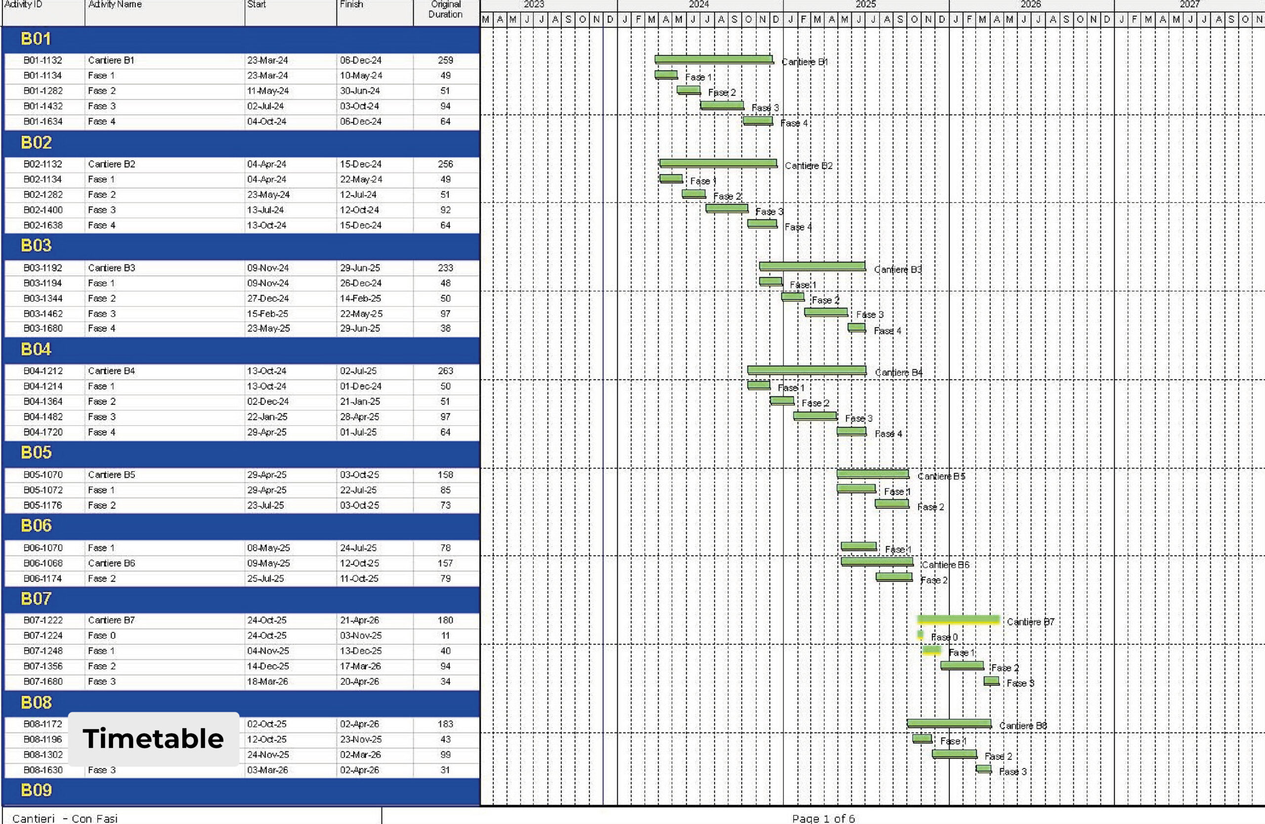
Planning is the layer that models all construction interventions at different points in time: the schedule and the construction site layout configuration are the characteristic variables of the layer and shape its outputs.
The construction scenarios implemented in the model are nothing more than combinations of variants, obtained from a vertical reading of the schedule (e.g. Gantt chart). Assuming that the Gantt chart’s horizontal axis coincides with the time axis, the construction activities active at that moment are listed (automatically).
This procedure is replicated for any number of dates distributed over the entire duration of the construction works. For a construction site characterised by rapid progress of the work fronts, a monthly temporal discretisation is considered adequate to describe the evolution of traffic flow parameters.
Thanks to a data- and simulation-based approach, the DST supports the decision-making process in identifying solutions that minimise mobility impacts and facilitates dialogue with the body responsible for building the infrastructure.
Verification and interpretation is the layer for estimating impacts in terms of flow distribution across the network, highlighting changes in the routes used, the links with increased flows, those with reduced flows, together with the corresponding change in accessibility of individual urban areas.
Decision is finally the layer of synthetic indicators, the information dashboard on the basis of which strategic and tactical decisions on construction are made: phase shifts, overlaps, layout, junction regulation, etc. Delay in travel times can become one of the main decision indicators.
on a monthly basis (on the 15th of each month)
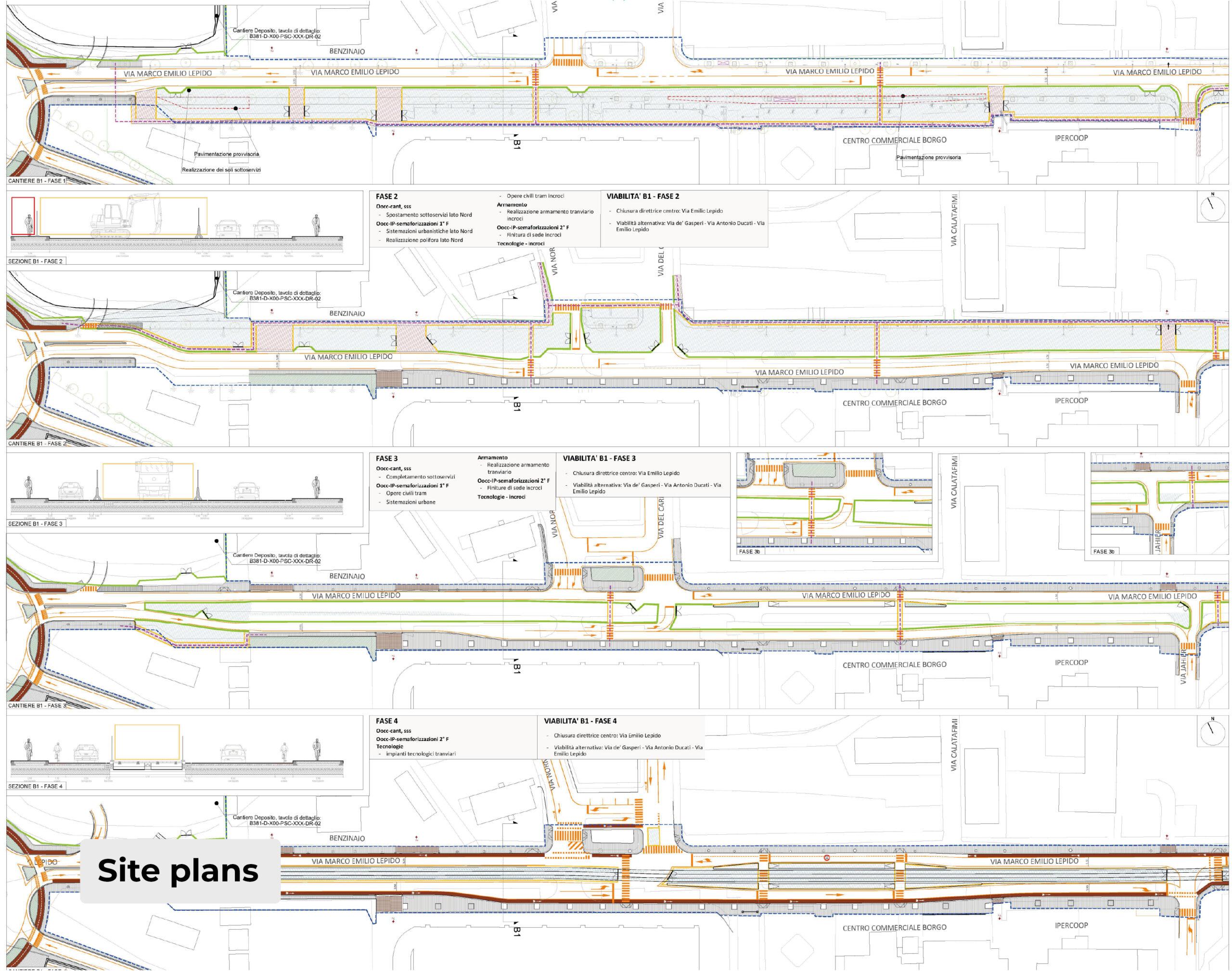
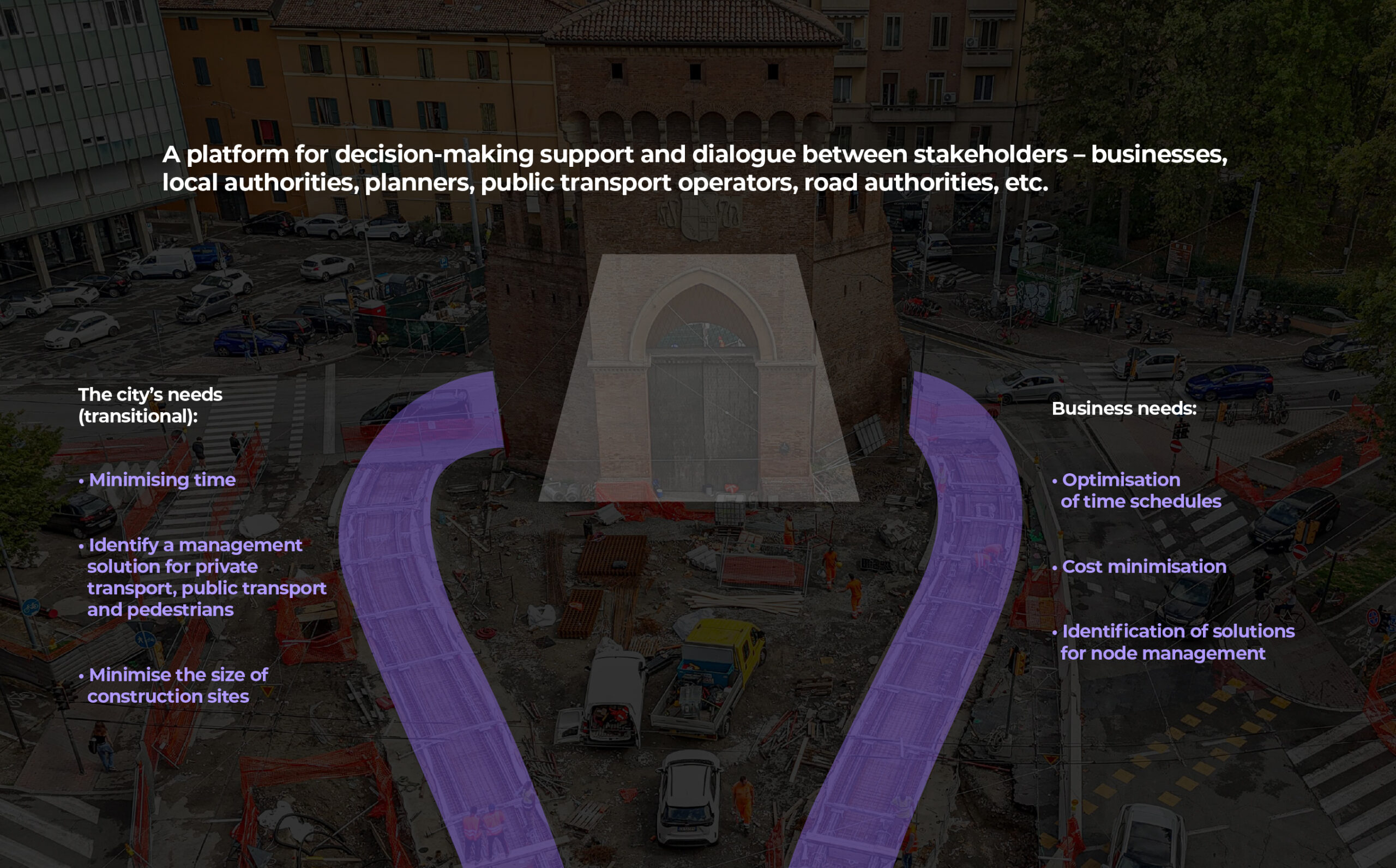
The decision support tool configured in this way thus becomes a “platform” synthesising the needs of the contractor in terms of optimising construction phases and those of the public administration in terms of mitigating impacts on people’s mobility, both by private vehicle and, even more so, by public transport. What’s more. A platform for dialogue, planning and monitoring that supports the administration in decisions on people’s mobility when it takes into account the simultaneity of construction sites related to other processes.
A platform for designing temporary signage, enabling the definition of user decision points, starting from the metropolitan area and then the urban one.
A platform for assessing the vulnerability of mobility networks during the construction phase, which does not depend solely on the extent or duration of the works, but is strongly influenced by the morphological and topological structure of the urban network in which the construction site is located.