Vicenza cycle path schedule


A support tool for planning sustainable mobility
The spread of sustainable mobility services in cities, plus discouraging use of private vehicles, is a central topic treated with increasing participation and commitment by public administrations.
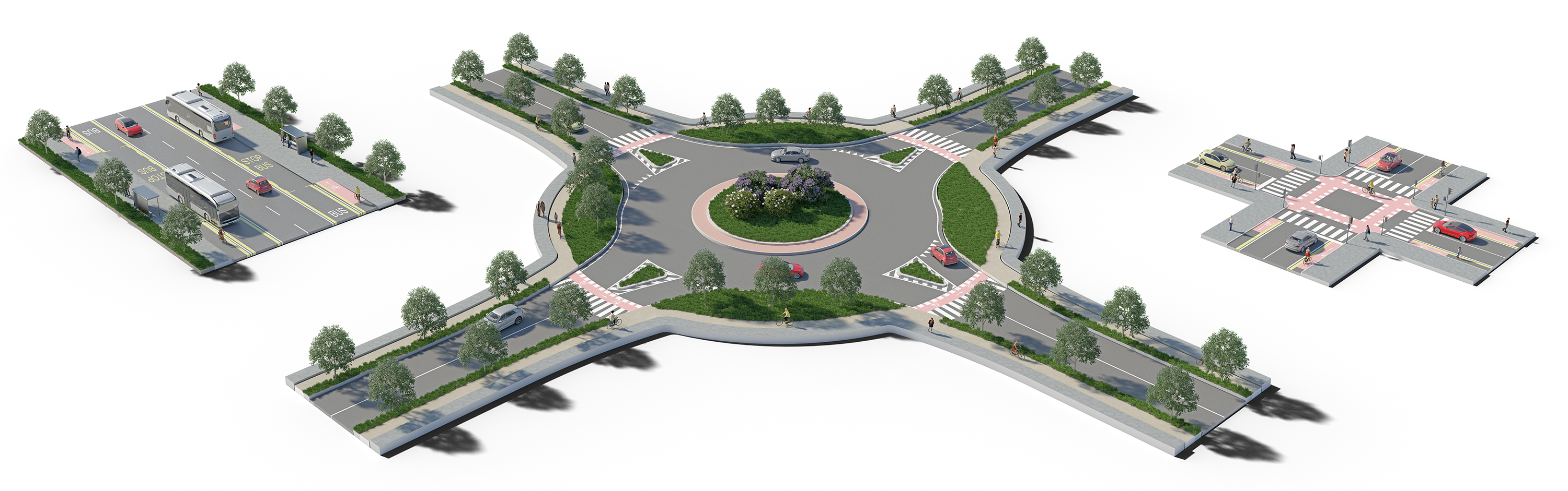
The Municipality of Vicenza took a cue from the best practices of European countries, more evolved in terms of cycling, and started planning sustainable mobility, aiming at encouraging use of bicycles as the alternative to the private car. Currently, cycle paths in the city have varying levels of comfort and danger. On one hand, the city has many cycle-pedestrian paths and two-way cycle paths physically separated from vehicle traffic but there can be problems at junctions and roundabouts. Therefore, to encourage cycle mobility, spaces must be specialised and, where this cannot be done, safe use of roads must be ensured for vehicles, cyclists and pedestrians.
With this background, the city of Vicenza called on NET Engineering to draft a schedule of cycle paths as part of the European ‘ITAT3022– PRO-BYKE’ project co-financed by the Fondo Europeo di sviluppo regionale e Interreg V-A Italia-Austria (European Fund for Regional and Inter-regional Development V-A Italy-Austria) as a support tool in planning type solutions for cycling. The aim of the schedule is to give type examples and guidelines for the future planning of cycle paths, directing the designer towards finding the best technical solution based on the operating situation, traffic conditions and the environmental context, respecting current Italian law and paying attention to design criteria and the innovative operations adopted by other countries.
When drafting the schedule, NET Engineering used Street Type, an innovative tool developed by Transport for London which defines a new support framework for political, operational and investment decisions for road transport infrastructure. The tool uses a classification matrix of nine categories to map city streets according to the type of movement people and goods
(not vehicles) make and the features of the places, i.e. businesses on the roads and their relationship with the urban fabric. Mapping city streets using the movement-place diagram provides public administrations with support in establishing a priority of the various streets, maximising use of the available space in the existing road network and establishing the need for strategic infrastructure interventions.
NET Engineering involved Cyface, a German start-up which devised a monitoring system for bike use and the state of the road surface, in the project with the aim of offering an extremely precise contribution to the client. Therefore. citizens were asked to download the Cyface app and use it on their bike journeys. This enabled bike use to be mapped, tracing the departure and arrival points, indicating aggregation points, i.e. points of interest for cycling, and also slow points – places where the administration should give priority to intervention.